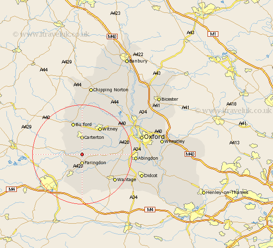
Oxfordshire Map Showing Location of Radcot
Population: 42
District: West Oxfordshire
Easting: 428803 Northing: 198415
Latitude: 51.68 Longitude: -1.58
 = Radcot
District: West Oxfordshire
Easting: 428803 Northing: 198415
Latitude: 51.68 Longitude: -1.58
= Radcot
This Radcot map below is supplied by Google. Use the tools in the top left corner to zoom into street level or zoom out for a road map, you may also need to zoom in to see Radcot on the map. Click and drag the map to move around. If the map fails to load try and refresh your browser or zoom in or out (+ or -).
Update - it seems Google no longer allow people to use their maps for free! This Radcot map sometimes loads and sometimes gives a error. I am working on a solution.
Closest 30 Towns or Cities to Radcot (Population over 500)
Clanfield 1.86km Faringdon 3.7km Bampton 5.07km Buckland 6.04km Carterton 7.42km Stanford in the Vale 8km Brize Norton 9.34km Shilton 9.34km Watchfield 9.88km Ducklington 10.12km Longworth 10.34km Shrivenham 10.34km Uffington 11.35km Kingston Bagpuize 11.64km Kingston Bagpuze 11.64km Standlake 12.07km Witney 13.08km Childrey 13.09km Minster Lovell 13.43km Burford 13.43km Stanton Harcourt 13.8km East Challow 14.43km Hanney 14.66km East Hanney 14.66km Hailey 14.69km Leafield 15.23km Letcombe Regis 15.9km North Leigh 16.58km Ensham 16.61km Eynsham 16.61km