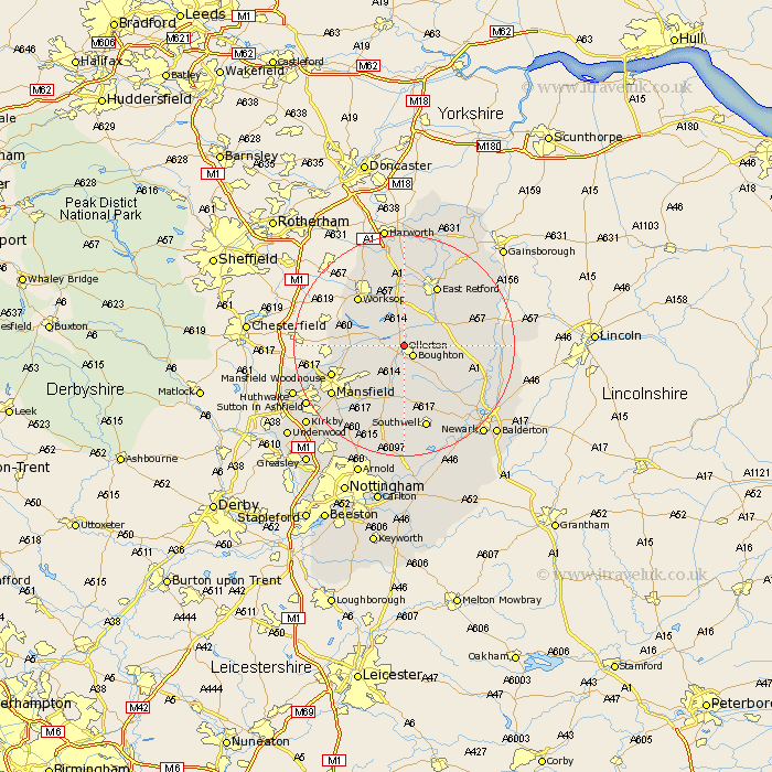
Nottinghamshire Map Showing Location of Ollerton
Population: 10299
Area Size (ha): 284
District: Newark and Sherwood
Easting: 465653 Northing: 369331
Latitude: 53.22 Longitude: -1.02
 = Ollerton
Area Size (ha): 284
District: Newark and Sherwood
Easting: 465653 Northing: 369331
Latitude: 53.22 Longitude: -1.02
= Ollerton
This Ollerton map below is supplied by Google. Use the tools in the top left corner to zoom into street level or zoom out for a road map, you may also need to zoom in to see Ollerton on the map. Click and drag the map to move around. If the map fails to load try and refresh your browser or zoom in or out (+ or -).
Update - it seems Google no longer allow people to use their maps for free! This Ollerton map sometimes loads and sometimes gives a error. I am working on a solution.
Closest 30 Towns or Cities to Ollerton (Population over 500)
Boughton 2.42km Walesby 2.89km Edwinstowe 4.99km Elksley 6.48km Elkesley 6.48km Clipstone 7.86km Tuxford 8.88km Warsop 9.07km Bilsthorpe 9.34km East Markham 9.62km Markham 9.62km Worksop 12.08km Grove 12.08km East Retford 12.42km Rainworth 12.96km Farnsfield 13.02km Mansfield Woodhouse 13.42km Shireoaks 14.94km Sutton 14.99km Mansfield 15.34km Southwell 15.7km Pleasley 16.51km Ramskill 16.68km Ranskill 16.68km Hayton 16.73km Clarborough 16.73km Blidworth 16.75km Blyth 17.01km Bampton 17.13km Rampton 17.13km