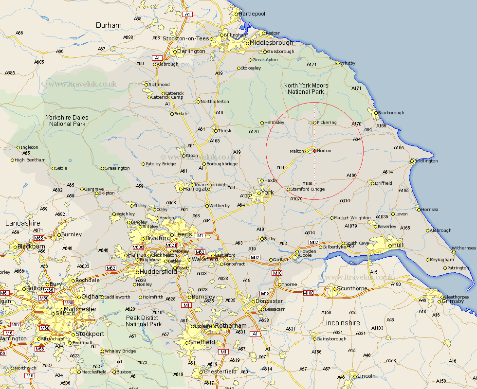
Yorkshire Map Showing Location of Norton
Population: 6219
Area Size (ha): 171
District: Ryedale
Easting: 480608 Northing: 471817
Latitude: 54.14 Longitude: -0.77
 = Norton
Area Size (ha): 171
District: Ryedale
Easting: 480608 Northing: 471817
Latitude: 54.14 Longitude: -0.77
= Norton
This Norton map below is supplied by Google. Use the tools in the top left corner to zoom into street level or zoom out for a road map, you may also need to zoom in to see Norton on the map. Click and drag the map to move around. If the map fails to load try and refresh your browser or zoom in or out (+ or -).
Update - it seems Google no longer allow people to use their maps for free! This Norton map sometimes loads and sometimes gives a error. I am working on a solution.
Closest 30 Towns or Cities to Norton (Population over 500)
Malton 2.85km Rillington 4.59km Slingsby 9.88km Thornton-le-Dale 11.22km Thornton Dale 11.22km Yedingham 12.04km Pickering 12.6km Terrington 13.22km Snainton 14.88km Sheriff Hutton 16.33km Sherburn 16.62km Brompton 16.67km Nawton 17.72km Kirkby Moorside 18.07km Kirby Moorside 18.07km Fangfoss 19.4km Stamford Bridge 19.67km Strensall 19.88km Wetwang 20.03km Willerby 21.26km Great Driffield 22.1km Wilberfoss 22.11km Pocklington 22.64km Barmby on the Moor 22.85km Barmby 22.85km Barmby-on-the-Moor 22.85km Stillington 23.17km Helmsley 23.23km Wigginton 23.69km Haxby 23.69km