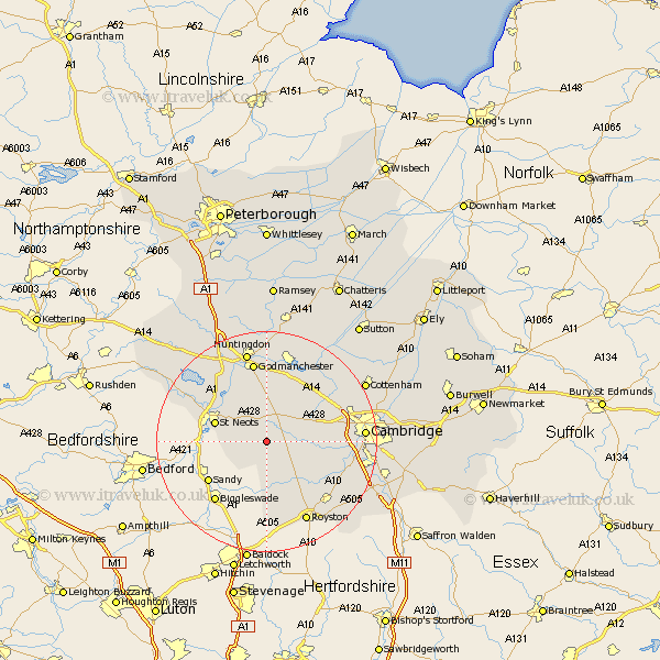
Cambridgeshire Map Showing Location of Gransden
Population: 969
District: Huntingdonshire
Easting: 527605 Northing: 255581
Latitude: 52.18 Longitude: -0.13
 = Gransden
District: Huntingdonshire
Easting: 527605 Northing: 255581
Latitude: 52.18 Longitude: -0.13
= Gransden
This Gransden map below is supplied by Google. Use the tools in the top left corner to zoom into street level or zoom out for a road map, you may also need to zoom in to see Gransden on the map. Click and drag the map to move around. If the map fails to load try and refresh your browser or zoom in or out (+ or -).
Update - it seems Google no longer allow people to use their maps for free! This Gransden map sometimes loads and sometimes gives a error. I am working on a solution.
Closest 30 Towns or Cities to Gransden (Population over 500)
Gamlingay 5.03km Papworth Everard 5.67km Papworth 5.67km Bourn 5.68km Toft 7.95km Elsworth 8.7km Great Paxton 9.34km Hilton 9.55km Orwell 9.71km St. Neots 9.82km St Neots 9.82km Saint Neots 9.82km Hardwick 10.39km Hardwicke 10.39km Little Paxton 10.87km Eaton Socon 10.88km Guilden Morden 11.12km Comberton 11.36km Hail Weston 11.64km Needham Market 11.95km Offord Cluny 12.01km Offord 12.01km Dry Drayton 12.65km Litlington 13.41km Barrington 13.57km Buckden 13.67km Haslingfield 13.69km Saint Ives 13.75km St Ives 13.75km Fen Stanton 13.75km