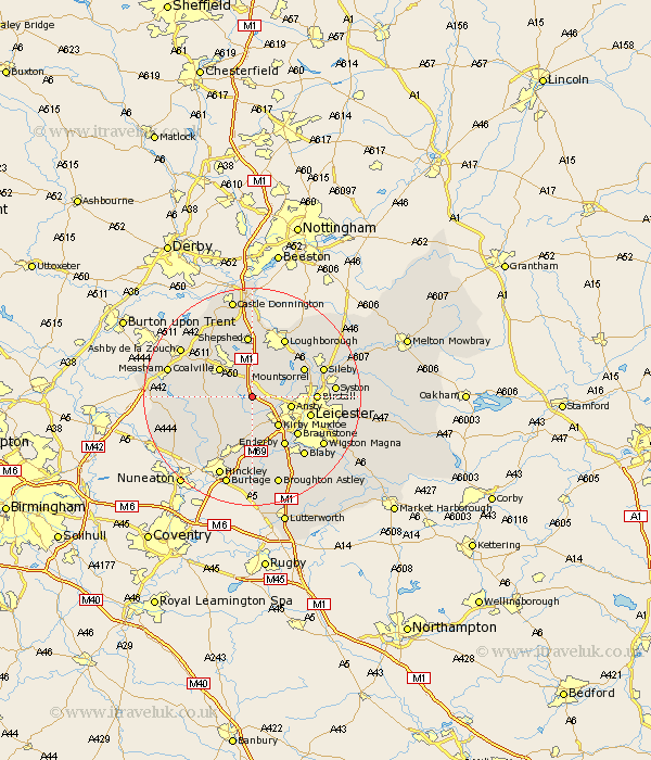
Leicestershire Map Showing Location of Markfield
Population: 3800
Area Size (ha): 107
District: Hinckley and Bosworth
Easting: 448460 Northing: 307944
Latitude: 52.67 Longitude: -1.28
 = Markfield
Area Size (ha): 107
District: Hinckley and Bosworth
Easting: 448460 Northing: 307944
Latitude: 52.67 Longitude: -1.28
= Markfield
This Markfield map below is supplied by Google. Use the tools in the top left corner to zoom into street level or zoom out for a road map, you may also need to zoom in to see Markfield on the map. Click and drag the map to move around. If the map fails to load try and refresh your browser or zoom in or out (+ or -).
Update - it seems Google no longer allow people to use their maps for free! This Markfield map sometimes loads and sometimes gives a error. I am working on a solution.
Closest 30 Towns or Cities to Markfield (Population over 500)
Bagworth 3.85km Desford 5.56km Newbold Verdon 6.5km Barlestone 6.74km Ansty 7km Anstey 7km Kirby Muxloe 7.15km Ibstock 7.87km Coalville 7.9km Woodhouse 7.9km Swannington 8.66km Ravenstone 8.69km Ravenstone with Snibston 8.69km Heather 9.18km Market Bosworth 9.64km Shackerstone 10.29km Mountsorrel 10.57km Rothley 10.77km Leicester 10.78km Leiscester 10.78km Quorndon 10.8km Braunstone 10.82km Enderby 10.85km Birstall 11.24km Sheepshed 11.51km Shepshed 11.51km Belton 11.62km Barrow upon Soar 11.64km Barrow 11.64km Coleorton 12.15km