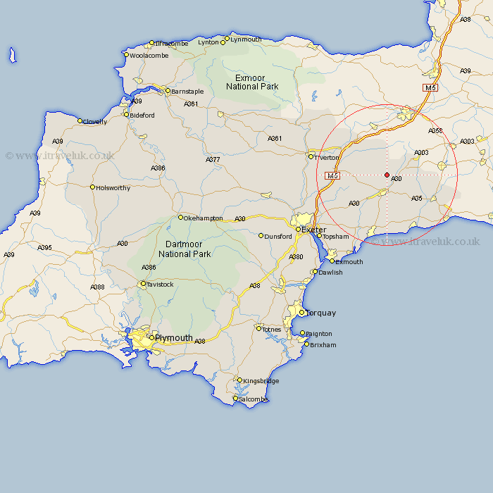
Devon Map Showing Location of Luppitt
Population: 444
District: East Devon
Easting: 316707 Northing: 106338
Latitude: 50.85 Longitude: -3.18
 = Luppitt
District: East Devon
Easting: 316707 Northing: 106338
Latitude: 50.85 Longitude: -3.18
= Luppitt
This Luppitt map below is supplied by Google. Use the tools in the top left corner to zoom into street level or zoom out for a road map, you may also need to zoom in to see Luppitt on the map. Click and drag the map to move around. If the map fails to load try and refresh your browser or zoom in or out (+ or -).
Update - it seems Google no longer allow people to use their maps for free! This Luppitt map sometimes loads and sometimes gives a error. I am working on a solution.
Closest 30 Towns or Cities to Luppitt (Population over 500)
Dunkeswell 2.99km Upottery 3.97km Honiton 5.56km Broadhembury 6.14km Hemyock 8.2km Gittisham 8.21km Yarcombe 8.4km Stockland 8.4km Culmstock 8.77km Kentisbeare 9.54km Payhembury 9.9km Uffculme 11.9km Talaton 11.95km Plymtree 12.28km Membury 12.28km Shute 12.37km Ottery Saint Mary 12.57km Ottery St. Mary 12.57km Ottery St Mary 12.57km Colyton 13.15km Willand 13.39km Kilmington 14.03km Chardstock 14.17km Burlescombe 14.53km Whimple 14.93km Cullompton 15.32km Musbury 15.32km Axminster 15.89km Bradninch 16.49km Branscombe 17.05km