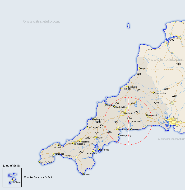
Cornwall Map Showing Location of Lostwithiel
Population: 2402
Area Size (ha): 68
District: Restormel
Easting: 210508 Northing: 59035
Latitude: 50.4 Longitude: -4.67
 = Lostwithiel
Area Size (ha): 68
District: Restormel
Easting: 210508 Northing: 59035
Latitude: 50.4 Longitude: -4.67
= Lostwithiel
This Lostwithiel map below is supplied by Google. Use the tools in the top left corner to zoom into street level or zoom out for a road map, you may also need to zoom in to see Lostwithiel on the map. Click and drag the map to move around. If the map fails to load try and refresh your browser or zoom in or out (+ or -).
Update - it seems Google no longer allow people to use their maps for free! This Lostwithiel map sometimes loads and sometimes gives a error. I am working on a solution.
Closest 30 Towns or Cities to Lostwithiel (Population over 500)
St. Blazey 3.54km St Blazey 3.54km Saint Blazey 3.54km Tywardreath 5.68km Par 6.59km Lanreath 7.33km Fowey 7.78km Lansallos 8km Bodmin 8.22km Lanteglos 8.22km Lanivet 9.01km Cardingham 9.34km Cardinham 9.34km Stenalees 9.54km Bugle 9.63km Pelynt 10.15km Roche 11.81km Dobwalls 11.99km Saint Austell 12.02km St. Austell 12.02km St Austell 12.02km Blisland 13.03km Duloe 13.13km Mevagissey 15.39km Mevegissey 15.39km St Denis 15.47km Saint Denis 15.47km Saint Dennis 15.47km St. Denis 15.47km St. Dennis 15.47km