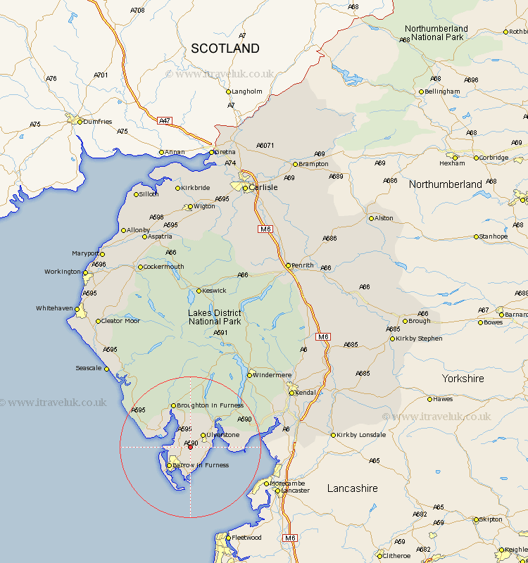
Cumbria Map Showing Location of Lindal
Population: 773
District: Barrow-in-Furness
Easting: 324928 Northing: 475174
Latitude: 54.17 Longitude: -3.15
 = Lindal
District: Barrow-in-Furness
Easting: 324928 Northing: 475174
Latitude: 54.17 Longitude: -3.15
= Lindal
This Lindal map below is supplied by Google. Use the tools in the top left corner to zoom into street level or zoom out for a road map, you may also need to zoom in to see Lindal on the map. Click and drag the map to move around. If the map fails to load try and refresh your browser or zoom in or out (+ or -).
Update - it seems Google no longer allow people to use their maps for free! This Lindal map sometimes loads and sometimes gives a error. I am working on a solution.
Closest 30 Towns or Cities to Lindal (Population over 500)
Lindal 0km Lindal in Furness 0km Pennington 2.14km Dalton in Furness 2.15km Dalton 2.15km Great Urswick 2.86km Askam 4.71km Askam in Furness 4.71km Ulverstone 4.93km Ulverston 4.93km Aldingham 6.44km Millom 8.45km Isle of Walney 10.75km Haverthwaite 11.4km Lower Holker 12.07km Holker 12.07km Colton 12.88km Bootle 17.95km Arnside 20.69km Coniston 22.89km Conistan 22.89km Hawkshead 24.28km Beetham 25.22km Milnthorpe 25.55km Levens 25.58km Heversham 26.01km Windermere 26.91km Holme 28.26km Natland 30.03km Ambleside 30.24km