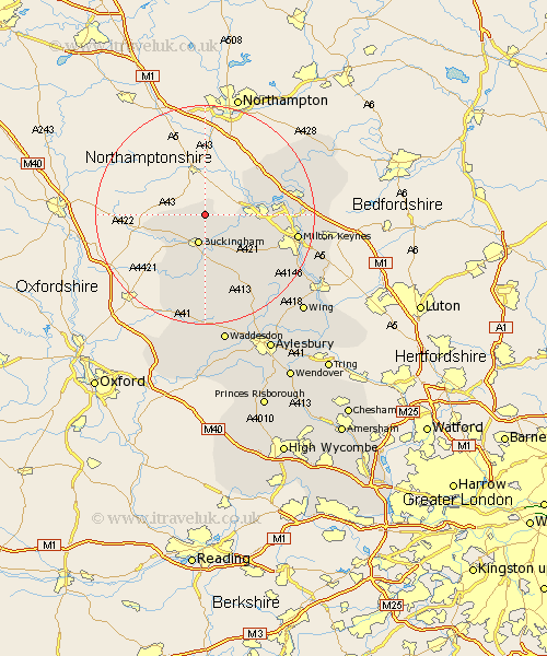
Buckinghamshire Map Showing Location of Lillingstone Dayrell
Population: 103
District: Aylesbury Vale
Easting: 470852 Northing: 239618
Latitude: 52.05 Longitude: -0.97
 = Lillingstone Dayrell
District: Aylesbury Vale
Easting: 470852 Northing: 239618
Latitude: 52.05 Longitude: -0.97
= Lillingstone Dayrell
This Lillingstone Dayrell map below is supplied by Google. Use the tools in the top left corner to zoom into street level or zoom out for a road map, you may also need to zoom in to see Lillingstone Dayrell on the map. Click and drag the map to move around. If the map fails to load try and refresh your browser or zoom in or out (+ or -).
Update - it seems Google no longer allow people to use their maps for free! This Lillingstone Dayrell map sometimes loads and sometimes gives a error. I am working on a solution.
Closest 30 Towns or Cities to Lillingstone Dayrell (Population over 500)
Akeley 1.86km Stowe 5.04km Maids Moreton 5.56km Buckingham 5.68km Stony Stratford 7.98km Thornborough 8.17km Padbury 9.33km Tingewick 9.36km Gawcott 9.54km Castlethorpe 9.84km Wolverton 10.26km Great Horwood 11.52km Hanslope 11.66km Bradwell 12.68km Steeple Claydon 13.03km Claydon 13.03km Winslow 13.06km Shenley 13.08km Shenley Church End 13.08km Twyford 13.75km Shenley Brook End 14.77km Great Linford 14.93km Stoke Goldington 15.55km Newton Longville 16.53km Mursley 16.55km Milton Keynes 16.78km Newport Pagnell 17.49km Bletchley 17.61km Marsh Gibbon 17.63km Simpson 18.61km