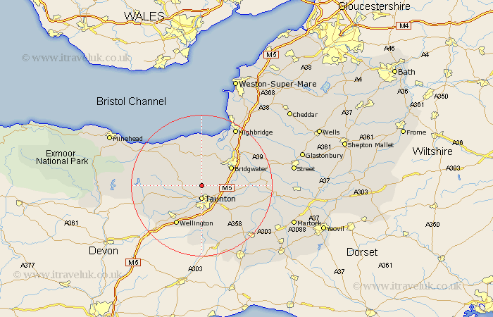
Somerset Map Showing Location of Kingston
Population: 892
District: Taunton Deane
Easting: 321764 Northing: 130359
Latitude: 51.07 Longitude: -3.12
 = Kingston
District: Taunton Deane
Easting: 321764 Northing: 130359
Latitude: 51.07 Longitude: -3.12
= Kingston
This Kingston map below is supplied by Google. Use the tools in the top left corner to zoom into street level or zoom out for a road map, you may also need to zoom in to see Kingston on the map. Click and drag the map to move around. If the map fails to load try and refresh your browser or zoom in or out (+ or -).
Update - it seems Google no longer allow people to use their maps for free! This Kingston map sometimes loads and sometimes gives a error. I am working on a solution.
Closest 30 Towns or Cities to Kingston (Population over 500)
Taunton 3.71km Norton Fitzwarren 4.38km Bishops Lydeard 4.66km West Monkton 5.02km Spaxton 5.56km Durleigh 7.25km Trull 7.42km North Petherton 7.91km Oake 8.05km Creech St. Michael 8.93km Creech Saint Michael 8.93km Creech St Michael 8.93km Bridgwater 9.86km Bridgewater 9.86km Nether Stowey 9.9km Milverton 10.85km Pitminster 11.12km North Curry 11.87km West Buckland 12.06km Hatch Beauchamp 12.35km Stoke Courcy 13.02km Stokscourey 13.02km Stogursey 13.02km Wellington 13.14km Otterhampton 13.17km Stoke Saint Gregory 13.34km Stoke St. Gregory 13.34km Stoke St Gregory 13.34km Weston Zoyland 13.96km Wiveliscombe 14.47km