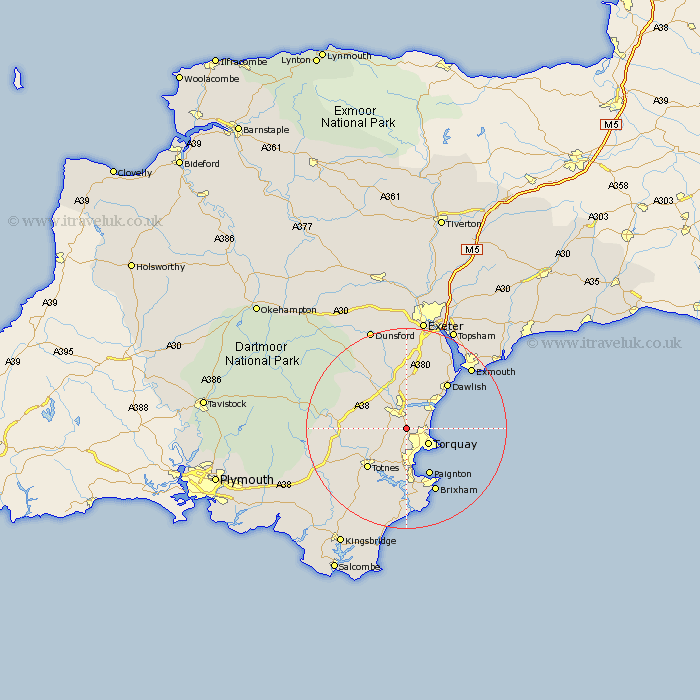
Devon Map Showing Location of Kingskerswell
Population: 3570
Area Size (ha): 110
District: Teignbridge
Easting: 287722 Northing: 67952
Latitude: 50.5 Longitude: -3.58
 = Kingskerswell
Area Size (ha): 110
District: Teignbridge
Easting: 287722 Northing: 67952
Latitude: 50.5 Longitude: -3.58
= Kingskerswell
This Kingskerswell map below is supplied by Google. Use the tools in the top left corner to zoom into street level or zoom out for a road map, you may also need to zoom in to see Kingskerswell on the map. Click and drag the map to move around. If the map fails to load try and refresh your browser or zoom in or out (+ or -).
Update - it seems Google no longer allow people to use their maps for free! This Kingskerswell map sometimes loads and sometimes gives a error. I am working on a solution.
Closest 30 Towns or Cities to Kingskerswell (Population over 500)
Abbotskerswell 2.36km Marldon 3.89km Newton Abbot 3.89km Stokeinteignhead 3.99km Ipplepen 4km Denbury 4.72km Kingsteignton 5.56km Torquay 5.59km Bishopsteignton 6.59km Broadhempston 7.31km Berry Pomeroy 8.79km Staverton 9.05km Teignmouth 9.95km Paignton 10.73km Chudleigh 11.12km Totnes 11.25km Stoke Gabriel 11.37km Bovey Tracey 11.65km Ashburton 11.93km Dawlish 12.4km Hennock 12.58km Ilsington 12.94km Harberton 13.23km Brixham 14.25km Buckfastleigh 14.27km Starcross 16.03km Lustleigh 16.03km Dartmouth 16.68km Kingswear 16.72km Kenton 16.96km