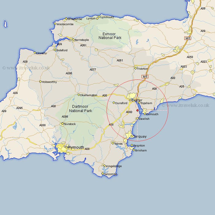
Devon Map Showing Location of Kenton
Population: 1131
District: Teignbridge
Easting: 296287 Northing: 82602
Latitude: 50.63 Longitude: -3.47
 = Kenton
District: Teignbridge
Easting: 296287 Northing: 82602
Latitude: 50.63 Longitude: -3.47
= Kenton
This Kenton map below is supplied by Google. Use the tools in the top left corner to zoom into street level or zoom out for a road map, you may also need to zoom in to see Kenton on the map. Click and drag the map to move around. If the map fails to load try and refresh your browser or zoom in or out (+ or -).
Update - it seems Google no longer allow people to use their maps for free! This Kenton map sometimes loads and sometimes gives a error. I am working on a solution.
Closest 30 Towns or Cities to Kenton (Population over 500)
Starcross 2.19km Lympstone 3.98km Exmouth 5.2km Dawlish 5.56km Exminster 5.68km Topsham 5.69km Woodbury Road Station 7.28km Exeter 8.78km Chudleigh 9.03km Teignmouth 9.26km Budleigh Salterton 9.4km Ide 10.23km Bishopsteignton 10.39km East Budleigh 10.74km Aylesbeare 11.65km Colyton Raleigh 11.95km Colaton Raleigh 11.95km Otterton 12.32km Kingsteignton 12.39km Christow 13.06km Stokeinteignhead 13.79km Newton Poppleford 13.89km Rockbeare 14.24km Whitestone 14.56km Newton Abbot 14.57km Hennock 14.59km Holcombe Burnell 14.96km Stoke Canon 15.02km Broad Clyst 15.02km Dunsford 16.26km