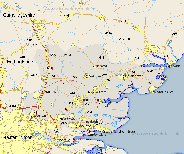
Essex Map Showing Location of Ingatestone
Population: 5775
Area Size (ha): 176
District: Brentwood
Easting: 564802 Northing: 199176
Latitude: 51.67 Longitude: 0.38
 = Ingatestone
Area Size (ha): 176
District: Brentwood
Easting: 564802 Northing: 199176
Latitude: 51.67 Longitude: 0.38
= Ingatestone
This Ingatestone map below is supplied by Google. Use the tools in the top left corner to zoom into street level or zoom out for a road map, you may also need to zoom in to see Ingatestone on the map. Click and drag the map to move around. If the map fails to load try and refresh your browser or zoom in or out (+ or -).
Update - it seems Google no longer allow people to use their maps for free! This Ingatestone map sometimes loads and sometimes gives a error. I am working on a solution.
Closest 30 Towns or Cities to Ingatestone (Population over 500)
Margaretting 2.95km Stock 3.92km Mountnessing 4.37km Billericay 6.02km Writtle 6.54km Galleywood 6.84km Kelvedon Hatch 6.9km Brentwood 7.22km Ramsden Heath 7.22km West Hanningfield 8.26km High Ongar 8.85km Great Baddow 8.85km Roxwell 9.26km Great Burstead 9.56km Herongate 9.59km Ingrave 9.89km Chipping Ongar 9.91km South Hanningfield 9.92km Chelmsford 10.12km Fyfield 10.93km Navestock 10.99km Stanford Rivers 11.49km East Hanningfield 11.49km Rettendon 11.65km Wickford 11.82km Broomfield 12.51km Basildon 12.52km Danbury 13.17km Great Waltham 13.75km Bicknacre 13.91km