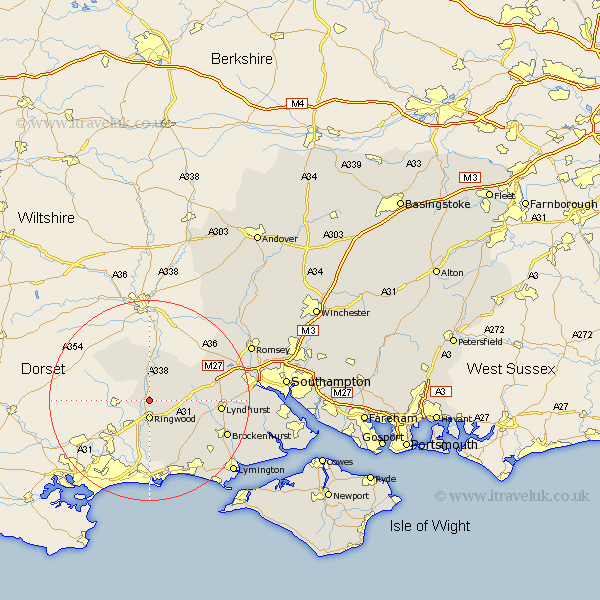
Hampshire Map Showing Location of Ibsley
Population: 1301
District: New Forest
Easting: 415240 Northing: 109396
Latitude: 50.88 Longitude: -1.78
 = Ibsley
District: New Forest
Easting: 415240 Northing: 109396
Latitude: 50.88 Longitude: -1.78
= Ibsley
This Ibsley map below is supplied by Google. Use the tools in the top left corner to zoom into street level or zoom out for a road map, you may also need to zoom in to see Ibsley on the map. Click and drag the map to move around. If the map fails to load try and refresh your browser or zoom in or out (+ or -).
Update - it seems Google no longer allow people to use their maps for free! This Ibsley map sometimes loads and sometimes gives a error. I am working on a solution.
Closest 30 Towns or Cities to Ibsley (Population over 500)
Sandleheath 2.34km Ringwood 3.7km Fordingbridge 5.68km South Damerham 7.26km Damerham 7.26km Hale 8.2km Burley 9.44km Bransgore 11.66km Minstead 12.86km Bramshaw 12.94km Sopley 12.97km Lyndhurst 14.15km Cadnam 14.51km West Wellow 16.81km Brockenhurst 16.92km Sway 17.01km Sherfield English 17.89km New Milton 19.13km Milton 19.13km Hordle 19.64km Barton-on-Sea 20.26km Barton on Sea 20.26km Barton 20.26km Eling 21.12km Totton 21.36km Boldre 21.83km Lymington 22.1km Milford on Sea 22.12km Milford-on-Sea 22.12km Milford 22.12km