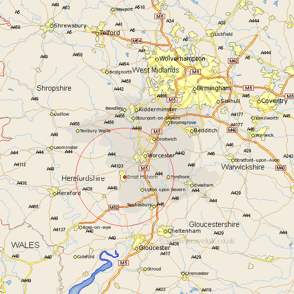
Worcestershire Map Showing Location of Malvern
Population: 32647
Area Size (ha): 1108
District: Malvern Hills
Easting: 378319 Northing: 246579
Latitude: 52.12 Longitude: -2.32
 = Malvern
Area Size (ha): 1108
District: Malvern Hills
Easting: 378319 Northing: 246579
Latitude: 52.12 Longitude: -2.32
= Malvern
This Malvern map below is supplied by Google. Use the tools in the top left corner to zoom into street level or zoom out for a road map, you may also need to zoom in to see Malvern on the map. Click and drag the map to move around. If the map fails to load try and refresh your browser or zoom in or out (+ or -).
Update - it seems Google no longer allow people to use their maps for free! This Malvern map sometimes loads and sometimes gives a error. I am working on a solution.
Closest 30 Towns or Cities to Malvern (Population over 500)
Malvern Wells 3.88km Hanley Castle 6.8km Seven Stoke 7.08km Severn Stoke 7.08km Powick 7.18km Leigh 7.41km Welland 7.5km Kempsey 8.18km Suckley 8.8km Upton on Severn 8.81km Upton 8.81km Upton upon Severn 8.81km Upton-on-Severn 8.81km Castlemorton 9.34km Wadborough 11.38km Hallow 12.01km Worcester 12.21km Ripple 13km Martley 13.41km Grimley 13.74km Defford 14.16km Eckington 14.75km Eldersfield 14.88km Fernhill Heath 15.21km Peopleton 15.24km Holt 15.5km Clifton 16.32km Clifton upon Teme 16.32km Crowle 16.49km Bredon 16.52km