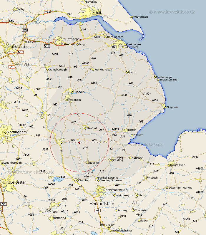
Lincolnshire Map Showing Location of Haceby
Population: 63
District: North Kesteven
Easting: 503126 Northing: 334753
Latitude: 52.9 Longitude: -0.47
 = Haceby
District: North Kesteven
Easting: 503126 Northing: 334753
Latitude: 52.9 Longitude: -0.47
= Haceby
This Haceby map below is supplied by Google. Use the tools in the top left corner to zoom into street level or zoom out for a road map, you may also need to zoom in to see Haceby on the map. Click and drag the map to move around. If the map fails to load try and refresh your browser or zoom in or out (+ or -).
Update - it seems Google no longer allow people to use their maps for free! This Haceby map sometimes loads and sometimes gives a error. I am working on a solution.
Closest 30 Towns or Cities to Haceby (Population over 500)
Ropsley 3.83km Folkingham 5.81km Ancaster 8.66km Billingborough 9.14km Belton 9.68km Pointon 10.53km Sleaford 11.05km Grantham 11.18km Rippingale 11.44km Corby 11.61km Helpringham 11.77km Heasingham 13.4km Leasingham 13.4km Great Hale 13.49km Hale 13.49km Great Gonerby 13.54km Heckington 14.35km Barrowby 14.53km Morton 14.61km Cranwell 14.82km Harlaxton 15km Colsterworth 15km Caythorpe 15.75km Ruskington 15.84km Buskington 15.84km Bourn 15.84km Bourne 15.84km Fulbeck 16.76km Brauncewell 16.83km Allington 17.17km