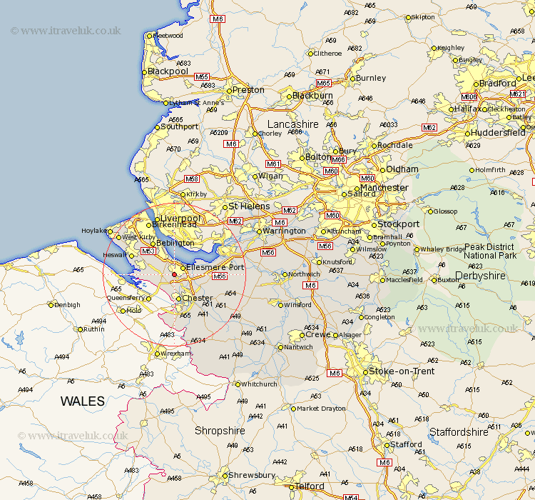
Cheshire Map Showing Location of Sutton
District: Ellesmere Port & Neston
Easting: 337757 Northing: 374848
Latitude: 53.27 Longitude: -2.93
 = Sutton
Easting: 337757 Northing: 374848
Latitude: 53.27 Longitude: -2.93
= Sutton
This Sutton map below is supplied by Google. Use the tools in the top left corner to zoom into street level or zoom out for a road map, you may also need to zoom in to see Sutton on the map. Click and drag the map to move around. If the map fails to load try and refresh your browser or zoom in or out (+ or -).
Update - it seems Google no longer allow people to use their maps for free! This Sutton map sometimes loads and sometimes gives a error. I am working on a solution.
Closest 30 Towns or Cities to Sutton (Population over 500)
Ellesmere Port 2.88km Mollington 3.88km Willaston 4.8km Great Saughall 5.67km Saughall 5.67km Chester 7.5km Neston 7.97km Elton 7.98km Dunham on the Hill 9.06km Dunham 9.06km Dunham-on-the-Hill 9.06km Mickle Trafford 9.55km Bebington and Bromborough 10.79km Bebington 10.79km Helsby 11.08km Christleton 11.42km Hale 11.55km Great Barrow 11.56km Barrow 11.56km Heswall 12.39km Tarvin 13.34km Frodsham 13.8km Waverton 14.23km Runcorn 14.26km Weston 14.41km Ashton 14.42km Dodleston 14.87km Widnes 16.2km Birkenhead 16.24km Halton 16.48km