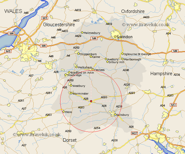
Wiltshire Map Showing Location of Fisherton De La Mere
District: Salisbury
Easting: 400000 Northing: 139029
Latitude: 51.15 Longitude: -2
 = Fisherton De La Mere
Easting: 400000 Northing: 139029
Latitude: 51.15 Longitude: -2
= Fisherton De La Mere
This Fisherton De La Mere map below is supplied by Google. Use the tools in the top left corner to zoom into street level or zoom out for a road map, you may also need to zoom in to see Fisherton De La Mere on the map. Click and drag the map to move around. If the map fails to load try and refresh your browser or zoom in or out (+ or -).
Update - it seems Google no longer allow people to use their maps for free! This Fisherton De La Mere map sometimes loads and sometimes gives a error. I am working on a solution.
Closest 30 Towns or Cities to Fisherton De La Mere (Population over 500)
Codford 3.49km Steeple Langford 5.01km Longford 5.01km Dinton 7.51km Shrewton 7.89km Heytesbury 8.94km South Newton 10.84km Hindon 10.84km Tisbury 10.94km West Lavington 11.12km Fovant 11.12km Wilton 11.9km Lark Hill 13.31km Warminster 13.94km Longbridge Deverill 14.07km Edington 14.73km Lavington 14.87km Market Lavington 14.87km East Knoyle 14.87km Bishop's Knoyle 14.87km Amesbury 15.22km Bratton 15.31km Erlestoke 15.53km Broad Chalke 15.54km Bishopstone 16.39km Coombe Bissett 16.68km Combebissett 16.68km Semley 16.68km Durrington 16.68km Dilton 16.74km