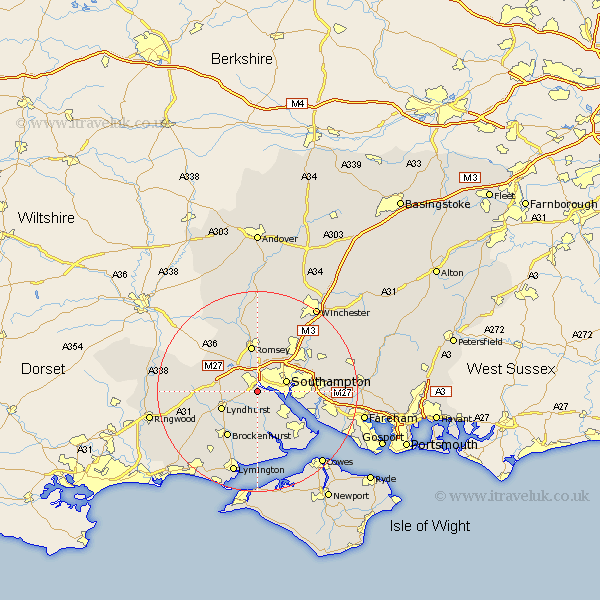
Hampshire Map Showing Location of Eling
Population: 27986
District: New Forest
Easting: 436328 Northing: 111357
Latitude: 50.9 Longitude: -1.48
 = Eling
District: New Forest
Easting: 436328 Northing: 111357
Latitude: 50.9 Longitude: -1.48
= Eling
This Eling map below is supplied by Google. Use the tools in the top left corner to zoom into street level or zoom out for a road map, you may also need to zoom in to see Eling on the map. Click and drag the map to move around. If the map fails to load try and refresh your browser or zoom in or out (+ or -).
Update - it seems Google no longer allow people to use their maps for free! This Eling map sometimes loads and sometimes gives a error. I am working on a solution.
Closest 30 Towns or Cities to Eling (Population over 500)
Totton 1.86km Marchwood 3.97km Dibden 5.1km Southampton 6.25km Hythe 6.92km Itchen 7.01km Cadnam 7.25km Chilworth 7.26km Lyndhurst 7.93km Minstead 8.39km Romsey 9.34km Bewley 9.55km Beaulieu 9.55km Bramshaw 10.05km West Wellow 10.2km West End 10.68km Brockenhurst 10.95km Netley 11.16km Netley Marsh 11.16km Ashurst 11.16km Sherfield English 11.61km Eastleigh 11.93km Bishopstoke 12.86km Hamble 12.95km Hample 12.95km Fawley 13.17km Locks Heath 13.37km Bursledon 13.38km Hursley 14.23km Otterbourne 14.52km