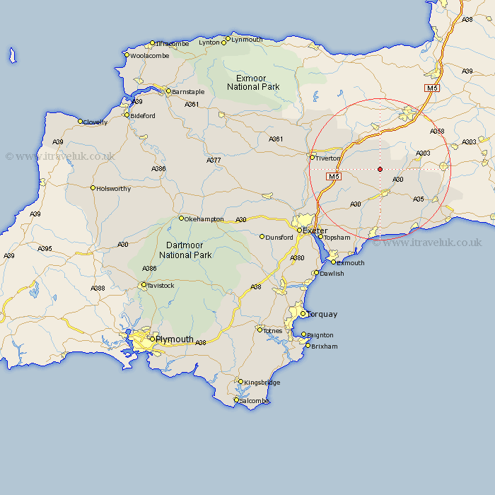
Devon Map Showing Location of Dunkeswell
Population: 1553
District: East Devon
Easting: 314391 Northing: 108233
Latitude: 50.87 Longitude: -3.22
 = Dunkeswell
District: East Devon
Easting: 314391 Northing: 108233
Latitude: 50.87 Longitude: -3.22
= Dunkeswell
This Dunkeswell map below is supplied by Google. Use the tools in the top left corner to zoom into street level or zoom out for a road map, you may also need to zoom in to see Dunkeswell on the map. Click and drag the map to move around. If the map fails to load try and refresh your browser or zoom in or out (+ or -).
Update - it seems Google no longer allow people to use their maps for free! This Dunkeswell map sometimes loads and sometimes gives a error. I am working on a solution.
Closest 30 Towns or Cities to Dunkeswell (Population over 500)
Broadhembury 5.11km Hemyock 5.68km Upottery 5.85km Culmstock 6.03km Kentisbeare 7.02km Honiton 7.78km Uffculme 8.98km Gittisham 9.35km Payhembury 9.45km Yarcombe 10.53km Willand 10.69km Plymtree 10.89km Stockland 11.17km Burlescombe 11.62km Talaton 11.63km Cullompton 12.87km Ottery St Mary 13.44km Ottery St. Mary 13.44km Ottery Saint Mary 13.44km Halberton 14.51km Bradninch 14.52km Holcombe Rogus 14.53km Whimple 14.54km Sampford Peverell 14.84km Membury 15.1km Shute 15.32km Colyton 16.01km Chardstock 16.8km Kilmington 17.02km Rockbeare 17.48km