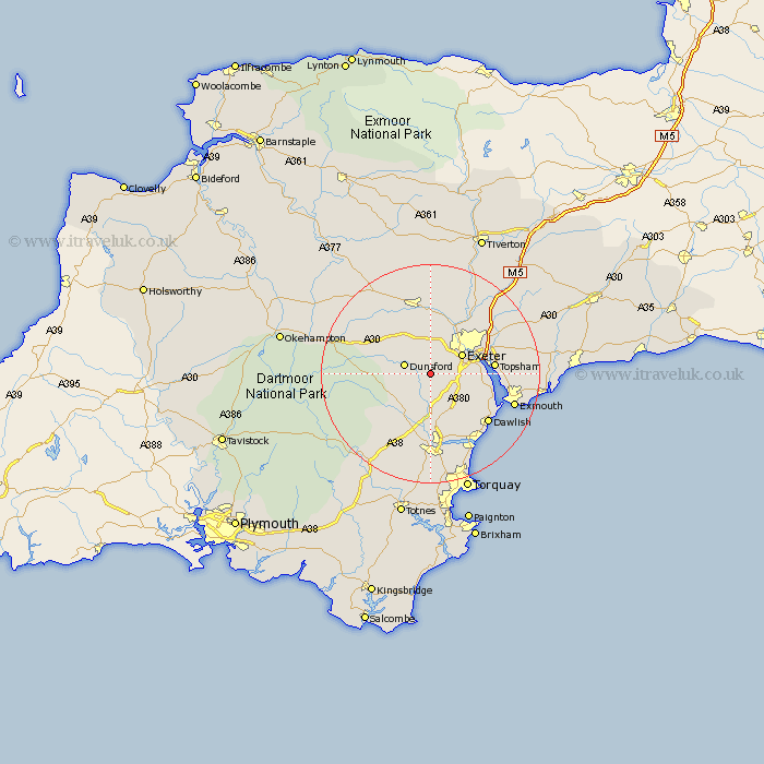
Devon Map Showing Location of Doddiscombsleigh
Population: 278
District: Teignbridge
Easting: 285762 Northing: 86536
Latitude: 50.67 Longitude: -3.62
 = Doddiscombsleigh
District: Teignbridge
Easting: 285762 Northing: 86536
Latitude: 50.67 Longitude: -3.62
= Doddiscombsleigh
This Doddiscombsleigh map below is supplied by Google. Use the tools in the top left corner to zoom into street level or zoom out for a road map, you may also need to zoom in to see Doddiscombsleigh on the map. Click and drag the map to move around. If the map fails to load try and refresh your browser or zoom in or out (+ or -).
Update - it seems Google no longer allow people to use their maps for free! This Doddiscombsleigh map sometimes loads and sometimes gives a error. I am working on a solution.
Closest 30 Towns or Cities to Doddiscombsleigh (Population over 500)
Christow 2.99km Dunsford 5.05km Ide 5.11km Holcombe Burnell 5.68km Exeter 6.94km Whitestone 7.5km Chudleigh 7.78km Hennock 8.21km Tedburn Saint Mary 8.77km Tedburn St. Mary 8.77km Tedburn St Mary 8.77km Lustleigh 8.98km Exminster 9.57km Moretonhampstead 9.58km Bovey Tracey 10.39km Cheriton Bishop 11.06km St Cyres 11.18km Newton St. Cyres 11.18km Newton Saint Cyres 11.18km Saint Cyres 11.18km Newton St Cyres 11.18km St. Cyres 11.18km Kenton 11.21km Topsham 11.89km Drewsteignton 12.31km Starcross 13km Crediton 13.18km Kingsteignton 13.19km Stoke Canon 13.82km Ilsington 13.83km