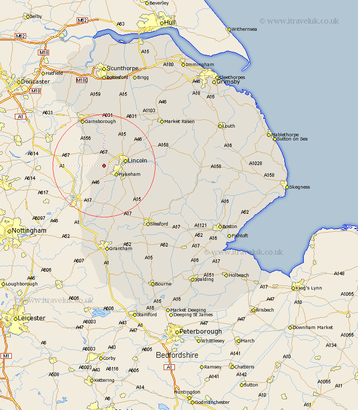
Lincolnshire Map Showing Location of Doddington
Population: 294
District: North Kesteven
Easting: 490133 Northing: 369731
Latitude: 53.22 Longitude: -0.65
 = Doddington
District: North Kesteven
Easting: 490133 Northing: 369731
Latitude: 53.22 Longitude: -0.65
= Doddington
This Doddington map below is supplied by Google. Use the tools in the top left corner to zoom into street level or zoom out for a road map, you may also need to zoom in to see Doddington on the map. Click and drag the map to move around. If the map fails to load try and refresh your browser or zoom in or out (+ or -).
Update - it seems Google no longer allow people to use their maps for free! This Doddington map sometimes loads and sometimes gives a error. I am working on a solution.
Closest 30 Towns or Cities to Doddington (Population over 500)
Skellingthorpe 2.89km Thorpe-on-the-Hill 3.88km Thorpe 3.88km Thorpe on the Hill 3.88km Eagle 4.33km Saxilby 5.56km Hykeham 5.79km North Hykeham 5.79km North Scarle 5.85km Aubourn 7.74km Lincoln 7.98km Swinderby 8.13km Torksey 9.25km Waddington 9.56km Scrampton 10.79km Scampton 10.79km Bassingham 11.18km Washingborough 12.21km Heighington 12.35km Nettleham 12.41km Marton 12.42km Branston 12.76km Ingham 13.7km Sudbrooke 14.42km Welton 14.45km Reepham 14.54km Fiskerton 14.54km Willingham 14.99km Cherry Willingham 15km Wellingore 15.13km