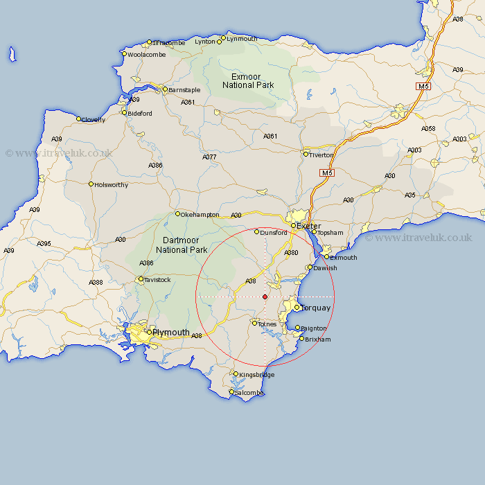
Devon Map Showing Location of Denbury
Population: 841
District: Teignbridge
Easting: 282994 Northing: 68055
Latitude: 50.5 Longitude: -3.65
 = Denbury
District: Teignbridge
Easting: 282994 Northing: 68055
Latitude: 50.5 Longitude: -3.65
= Denbury
This Denbury map below is supplied by Google. Use the tools in the top left corner to zoom into street level or zoom out for a road map, you may also need to zoom in to see Denbury on the map. Click and drag the map to move around. If the map fails to load try and refresh your browser or zoom in or out (+ or -).
Update - it seems Google no longer allow people to use their maps for free! This Denbury map sometimes loads and sometimes gives a error. I am working on a solution.
Closest 30 Towns or Cities to Denbury (Population over 500)
Ipplepen 2.2km Abbotskerswell 2.36km Broadhempston 3km Kingskerswell 4.72km Staverton 5.12km Newton Abbot 5.12km Marldon 5.12km Kingsteignton 7.29km Ashburton 7.31km Berry Pomeroy 7.42km Stokeinteignhead 8.46km Totnes 8.81km Ilsington 9.47km Bovey Tracey 9.56km Buckfastleigh 9.61km Torquay 9.78km Bishopsteignton 9.95km Harberton 10.4km Hennock 11.18km Stoke Gabriel 11.37km Chudleigh 12.08km Widdecombe 12.94km Widecombe in the Moor 12.94km Paignton 13.49km Lustleigh 13.8km Teignmouth 14.1km Diptford 14.59km Brent 14.95km South Brent 14.95km Dawlish 15.93km