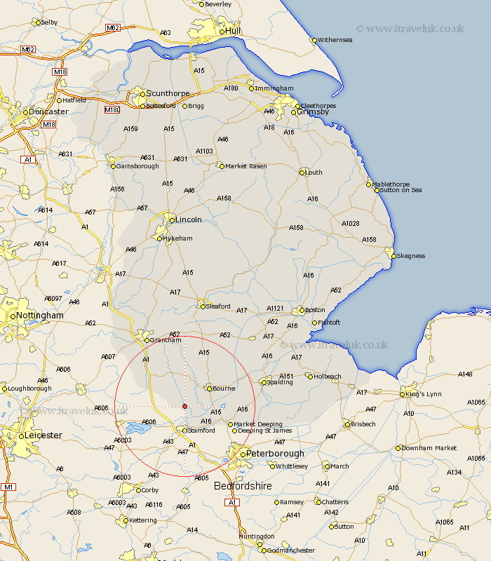
Lincolnshire Map Showing Location of Careby
Population: 146
District: South Kesteven
Easting: 502436 Northing: 314343
Latitude: 52.72 Longitude: -0.48
 = Careby
District: South Kesteven
Easting: 502436 Northing: 314343
Latitude: 52.72 Longitude: -0.48
= Careby
This Careby map below is supplied by Google. Use the tools in the top left corner to zoom into street level or zoom out for a road map, you may also need to zoom in to see Careby on the map. Click and drag the map to move around. If the map fails to load try and refresh your browser or zoom in or out (+ or -).
Update - it seems Google no longer allow people to use their maps for free! This Careby map sometimes loads and sometimes gives a error. I am working on a solution.
Closest 30 Towns or Cities to Careby (Population over 500)
Castle Bytham 3.84km Stamford 7.42km Thurlby 7.86km Uffington 8.67km Bourn 8.73km Bourne 8.73km Baston 9.17km Corby 9.53km South Witham 9.71km Langfoft 10.27km Langtoft 10.27km Morton 10.8km Colsterworth 12.9km Market Deeping 13.55km Rippingale 13.61km Deeping Saint James 15.39km Deeping St James 15.39km Deeping St. James 15.39km Folkingham 17.6km Pointon 17.93km Ropsley 18.66km Deeping St Nicholas 19.08km Deeping Saint Nicholas 19.08km Deeping St. Nicholas 19.08km Billingborough 21.09km Harlaxton 21.43km Spalding 22.56km Grantham 22.74km Crowland 23.14km Croyland 23.14km