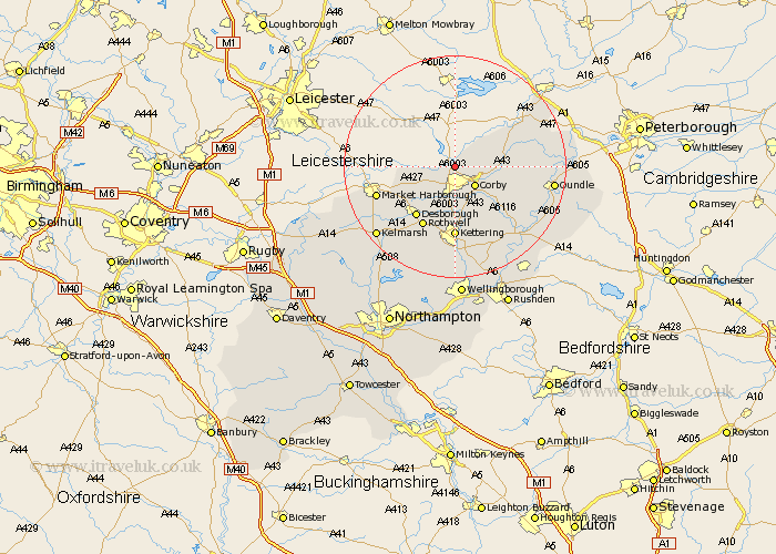
Northamptonshire Map Showing Location of Caldecott
Population: 541
District: East Northamptonshire
Easting: 487073 Northing: 291793
Latitude: 52.52 Longitude: -0.72
 = Caldecott
District: East Northamptonshire
Easting: 487073 Northing: 291793
Latitude: 52.52 Longitude: -0.72
= Caldecott
This Caldecott map below is supplied by Google. Use the tools in the top left corner to zoom into street level or zoom out for a road map, you may also need to zoom in to see Caldecott on the map. Click and drag the map to move around. If the map fails to load try and refresh your browser or zoom in or out (+ or -).
Update - it seems Google no longer allow people to use their maps for free! This Caldecott map sometimes loads and sometimes gives a error. I am working on a solution.
Closest 30 Towns or Cities to Caldecott (Population over 500)
Gretton 3.85km Cottingham 4.35km Corby 5.02km Wilbarston 6.75km Weldon 6.75km Stanion 7.16km Geddington 9.54km Brigstock 10.84km Desborough 11.48km Rowell 12.47km Rothwell 12.47km Kettering 12.98km King's Cliffe 15.67km Kings Cliffe 15.67km Broughton 17.02km Oundle 17.33km Thrapston 17.96km Isham 18.57km Burton Latimer 18.84km Clipston 19.33km Islip 19.35km Woodford 19.54km Titchmarsh 20.45km Nassington 20.63km Finedon 21.16km Walgrave 21.49km Warmington 21.51km Ringstead 21.71km Naseby 23.38km Irthlingborough 23.6km