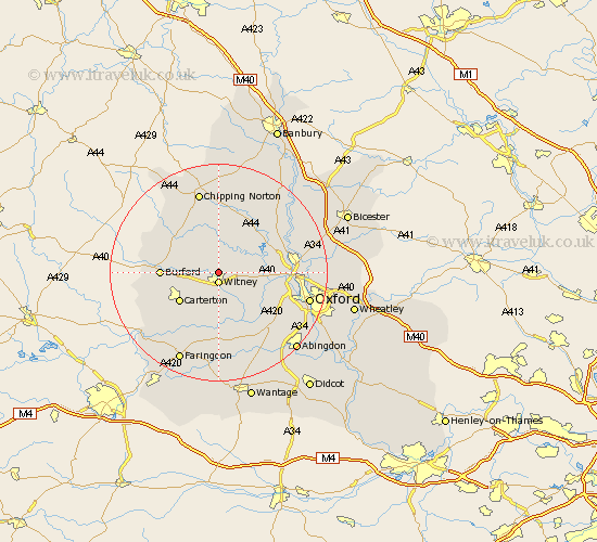
Oxfordshire Map Showing Location of Hailey
Population: 1158
District: West Oxfordshire
Easting: 435623 Northing: 211437
Latitude: 51.8 Longitude: -1.48
 = Hailey
District: West Oxfordshire
Easting: 435623 Northing: 211437
Latitude: 51.8 Longitude: -1.48
= Hailey
This Hailey map below is supplied by Google. Use the tools in the top left corner to zoom into street level or zoom out for a road map, you may also need to zoom in to see Hailey on the map. Click and drag the map to move around. If the map fails to load try and refresh your browser or zoom in or out (+ or -).
Update - it seems Google no longer allow people to use their maps for free! This Hailey map sometimes loads and sometimes gives a error. I am working on a solution.
Closest 30 Towns or Cities to Hailey (Population over 500)
Witney 1.86km Minster Lovell 3.44km North Leigh 3.44km Leafield 3.91km Stonesfield 5.05km Ducklington 5.56km Brize Norton 6.83km Church Handborough 6.88km Hanborough 6.88km Charlbury 7.5km Ensham 7.81km Eynsham 7.81km Shilton 8.84km Shipton 8.84km Shipton-under-Wychwood 8.84km Shipton under Wychwood 8.84km Carterton 8.85km Bladon 9.35km Cassington 9.36km Stanton Harcourt 9.37km Chadlington 9.54km Bampton 9.88km Burford 10.31km Standlake 10.34km Yarnton 12.61km Woodstock 12.73km Churchill 13.07km Clanfield 13.08km Enstone 13.18km Longworth 13.43km