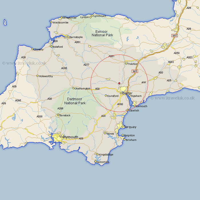
Devon Map Showing Location of Upton Pyne
Population: 479
District: East Devon
Easting: 290705 Northing: 97554
Latitude: 50.77 Longitude: -3.55
 = Upton Pyne
District: East Devon
Easting: 290705 Northing: 97554
Latitude: 50.77 Longitude: -3.55
= Upton Pyne
This Upton Pyne map below is supplied by Google. Use the tools in the top left corner to zoom into street level or zoom out for a road map, you may also need to zoom in to see Upton Pyne on the map. Click and drag the map to move around. If the map fails to load try and refresh your browser or zoom in or out (+ or -).
Update - it seems Google no longer allow people to use their maps for free! This Upton Pyne map sometimes loads and sometimes gives a error. I am working on a solution.
Closest 30 Towns or Cities to Upton Pyne (Population over 500)
Newton St. Cyres 3.52km Saint Cyres 3.52km Newton St Cyres 3.52km Newton Saint Cyres 3.52km St. Cyres 3.52km St Cyres 3.52km Stoke Canon 3.52km Thorverton 3.88km Whitestone 5.12km Silverton 7.27km Crediton 7.27km Ide 7.51km Exeter 7.51km Holcombe Burnell 8.08km Broad Clyst 8.21km Sandford 9.91km Tedburn St Mary 10.09km Tedburn Saint Mary 10.09km Tedburn St. Mary 10.09km Cheriton Fitzpaine 10.38km Exminster 10.39km Topsham 11.64km Rockbeare 11.87km Bradninch 11.94km Dunsford 13.19km Cheriton Bishop 13.42km Aylesbeare 14.05km Woodbury Road Station 14.05km Whimple 14.07km Copplestone 14.54km