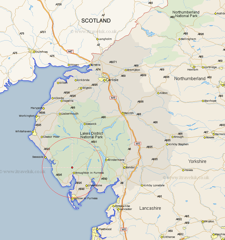
Cumbria Map Showing Location of Ulpha
Population: 159
District: Copeland
Easting: 319780 Northing: 491953
Latitude: 54.32 Longitude: -3.23
 = Ulpha
District: Copeland
Easting: 319780 Northing: 491953
Latitude: 54.32 Longitude: -3.23
= Ulpha
This Ulpha map below is supplied by Google. Use the tools in the top left corner to zoom into street level or zoom out for a road map, you may also need to zoom in to see Ulpha on the map. Click and drag the map to move around. If the map fails to load try and refresh your browser or zoom in or out (+ or -).
Update - it seems Google no longer allow people to use their maps for free! This Ulpha map sometimes loads and sometimes gives a error. I am working on a solution.
Closest 30 Towns or Cities to Ulpha (Population over 500)
Bootle 10.29km Conistan 12.15km Coniston 12.15km Colton 13.13km Millom 13.16km Askam 14.87km Askam in Furness 14.87km Ulverstone 15.6km Ulverston 15.6km Gosforth 15.93km Hawkshead 16.11km Pennington 16.19km Haverthwaite 16.85km Lindal 17.54km Lindal in Furness 17.54km Seascale 17.81km Dalton in Furness 19.04km Dalton 19.04km Great Urswick 20.03km Ambleside 20.54km Windermere 21.27km Holker 22.81km Lower Holker 22.81km Aldingham 23.87km Egremont 24.79km Isle of Walney 25.95km Staveley 27.57km Cleator Moor 28.82km Frizington 29.01km Lamplugh 29.81km