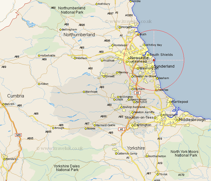
Durham Map Showing Location of Whitburn
Population: 5797
Area Size (ha): 109
District: South Tyneside
Easting: 440431 Northing: 562263
Latitude: 54.95 Longitude: -1.37
 = Whitburn
Area Size (ha): 109
District: South Tyneside
Easting: 440431 Northing: 562263
Latitude: 54.95 Longitude: -1.37
= Whitburn
This Whitburn map below is supplied by Google. Use the tools in the top left corner to zoom into street level or zoom out for a road map, you may also need to zoom in to see Whitburn on the map. Click and drag the map to move around. If the map fails to load try and refresh your browser or zoom in or out (+ or -).
Update - it seems Google no longer allow people to use their maps for free! This Whitburn map sometimes loads and sometimes gives a error. I am working on a solution.
Closest 30 Towns or Cities to Whitburn (Population over 500)
Marsden 1.5km Sunderland 4.7km Jarrow 6.06km Jarrow on Tyne 6.06km Jarrow-on-Tyne 6.06km Boldon 6.27km West Boldon 6.27km Hebburn on Tyne 9.57km Hebburn-on-Tyne 9.57km Hebburn 9.57km Washington 11.16km Washington New Town 11.16km Felling 12.22km Houghton le Spring 13.09km Seaham 13.11km Seaham Harbour 13.11km Seaton 13.38km Birtley 14.86km Dalton 15.19km Dalton le Dale 15.19km Lamesley 15.33km Murton 15.5km Gateshead-on-Tyne 15.92km Gateshead on Tyne 15.92km Gateshead 15.92km Hetton le Hole 16.06km Ouston Moor 17.01km Ouston 17.01km Chester-le-Street 17.1km South Hetton 17.16km