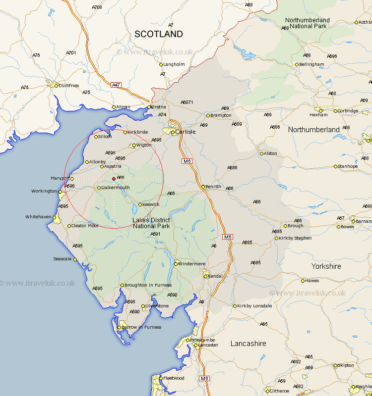
Cumbria Map Showing Location of Sunderland
District: Allerdale
Easting: 318379 Northing: 534634
Latitude: 54.7 Longitude: -3.27
 = Sunderland
Easting: 318379 Northing: 534634
Latitude: 54.7 Longitude: -3.27
= Sunderland
This Sunderland map below is supplied by Google. Use the tools in the top left corner to zoom into street level or zoom out for a road map, you may also need to zoom in to see Sunderland on the map. Click and drag the map to move around. If the map fails to load try and refresh your browser or zoom in or out (+ or -).
Update - it seems Google no longer allow people to use their maps for free! This Sunderland map sometimes loads and sometimes gives a error. I am working on a solution.
Closest 30 Towns or Cities to Sunderland (Population over 500)
Cockermouth 6.51km Bridekirk 6.69km Aspatria 7.02km Dearham 10.71km Bromfield 11.12km Brigham 11.13km Crosscanonby 11.33km Westward 12.61km Broughton Moor 12.99km Caldbeck 14.4km Keswick 14.72km Koswick 14.72km Maryport 14.99km Dean 15.45km Flimby 16.17km Hesket Newmarket 16.48km Wigton 16.6km Lamplugh 17.13km Silloth 19.61km Workington 20.07km Thursby 20.32km Kirkbride 20.83km Distington 21.51km Frizington 23.2km Dalston 23.45km Lowca 24.16km Parton 25.2km Skelton 25.7km Cleator Moor 25.97km Greystoke 26.31km