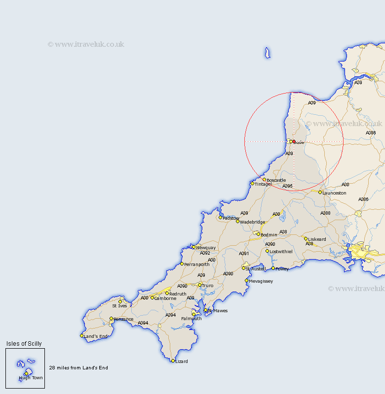
Cornwall Map Showing Location of Stratton
District: North Cornwall
Easting: 222802 Northing: 106832
Latitude: 50.83 Longitude: -4.52
 = Stratton
Easting: 222802 Northing: 106832
Latitude: 50.83 Longitude: -4.52
= Stratton
This Stratton map below is supplied by Google. Use the tools in the top left corner to zoom into street level or zoom out for a road map, you may also need to zoom in to see Stratton on the map. Click and drag the map to move around. If the map fails to load try and refresh your browser or zoom in or out (+ or -).
Update - it seems Google no longer allow people to use their maps for free! This Stratton map sometimes loads and sometimes gives a error. I am working on a solution.
Closest 30 Towns or Cities to Stratton (Population over 500)
Bude 1.17km Marhamchurch 3.7km Markhamchurch 3.7km Kilkhampton 6.03km Pounstock 7.77km Poundstock 7.77km Morwenstow 7.78km Moorwinstow 7.78km North Petherwin 17.68km Forrabury 21.82km Launceston 24.62km Tintagel 24.75km South Petherwin 25.85km Altarnun 25.97km Lewannick 26.6km Camelford 26.79km Lezant 30.17km North Hill 32.04km Linkinhorne 34.99km Blisland 37.11km Cardinham 40.04km Cardingham 40.04km Callington 40.08km Wadebridge 41.68km Dobwalls 42.62km Liskeard 42.88km Bodmin 43.13km Padstow 44.44km Bere Alston 44.87km Calstock 44.87km