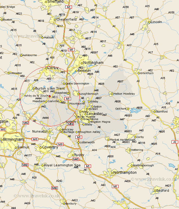
Leicestershire Map Showing Location of Ashby De La Zouch
Population: 10436
Area Size (ha): 292
District: North West Leicestershire
Easting: 435994 Northing: 317102
Latitude: 52.75 Longitude: -1.47
 = Ashby De La Zouch
Area Size (ha): 292
District: North West Leicestershire
Easting: 435994 Northing: 317102
Latitude: 52.75 Longitude: -1.47
= Ashby De La Zouch
This Ashby De La Zouch map below is supplied by Google. Use the tools in the top left corner to zoom into street level or zoom out for a road map, you may also need to zoom in to see Ashby De La Zouch on the map. Click and drag the map to move around. If the map fails to load try and refresh your browser or zoom in or out (+ or -).
Update - it seems Google no longer allow people to use their maps for free! This Ashby De La Zouch map sometimes loads and sometimes gives a error. I am working on a solution.
Closest 30 Towns or Cities to Ashby De La Zouch (Population over 500)
Packington 3.7km Measham 4.33km Coleorton 4.49km Worthington 4.86km Breedon on the Hill 5.82km Breedon 5.82km Breedon-on-the-Hill 5.82km Donisthorpe 5.82km Ravenstone 7.15km Ravenstone with Snibston 7.15km Coalville 7.69km Swannington 8.07km Heather 8.15km Belton 9.16km Appleby Magna 9.86km Ibstock 10.29km Diseworth 10.55km Shackerstone 11.34km Sheepshed 11.87km Shepshed 11.87km Castle Donnington 12.89km Castle Donington 12.89km Twycross 13.17km Bagworth 14.3km Barlestone 14.62km Hathern 15.04km Kegworth 15.36km Markfield 15.44km Market Bosworth 15.49km Sheepy 17.02km