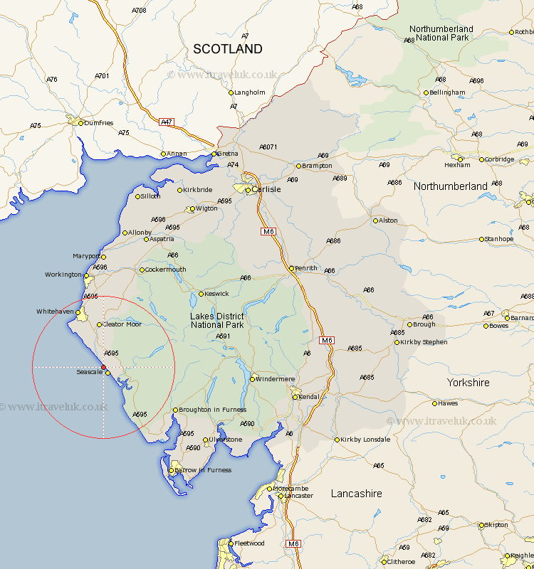
Cumbria Map Showing Location of Sellafield
District: Copeland
Easting: 302633 Northing: 501555
Latitude: 54.4 Longitude: -3.5
 = Sellafield
Easting: 302633 Northing: 501555
Latitude: 54.4 Longitude: -3.5
= Sellafield
This Sellafield map below is supplied by Google. Use the tools in the top left corner to zoom into street level or zoom out for a road map, you may also need to zoom in to see Sellafield on the map. Click and drag the map to move around. If the map fails to load try and refresh your browser or zoom in or out (+ or -).
Update - it seems Google no longer allow people to use their maps for free! This Sellafield map sometimes loads and sometimes gives a error. I am working on a solution.
Closest 30 Towns or Cities to Sellafield (Population over 500)
Seascale 2.15km Gosforth 4.32km Egremont 7.5km Cleator Moor 13.02km St Bees 13.44km St. Bees 13.44km St. Bega 13.44km St Bega 13.44km Saint Bega 13.44km Saint Bees 13.44km Frizington 14.86km Bootle 17.16km Whitehaven 17.89km Parton 19.3km Lamplugh 19.63km Distington 20.49km Lowca 21.08km Dean 22.65km Millom 26.9km Workington 28.13km Conistan 28.3km Coniston 28.3km Brigham 28.31km Askam 30.31km Askam in Furness 30.31km Cockermouth 31.2km Flimby 31.52km Broughton Moor 31.58km Hawkshead 32.59km Bridekirk 32.66km