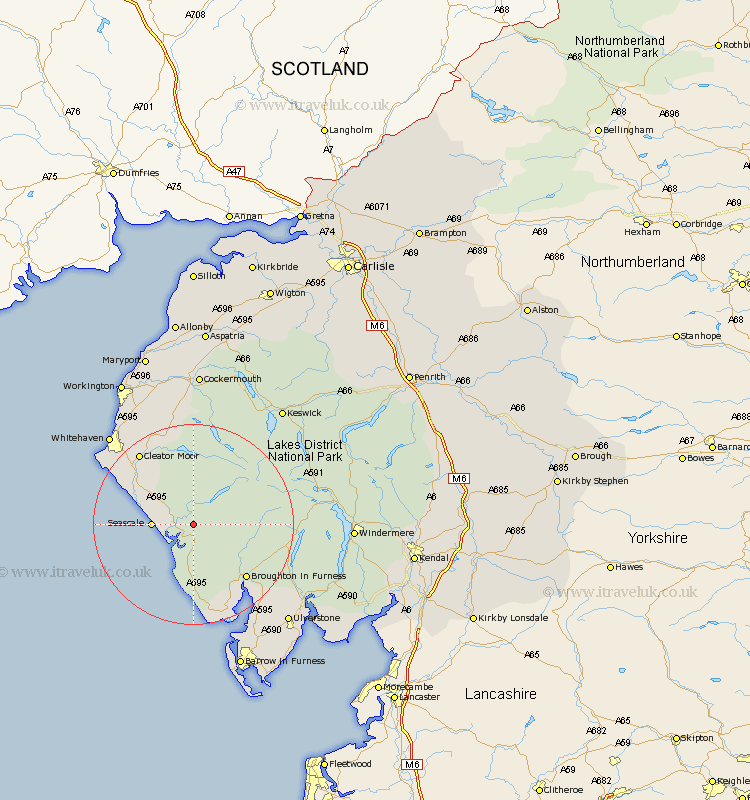
Cumbria Map Showing Location of Santon Bridge
District: Copeland
Easting: 311251 Northing: 499521
Latitude: 54.38 Longitude: -3.37
 = Santon Bridge
Easting: 311251 Northing: 499521
Latitude: 54.38 Longitude: -3.37
= Santon Bridge
This Santon Bridge map below is supplied by Google. Use the tools in the top left corner to zoom into street level or zoom out for a road map, you may also need to zoom in to see Santon Bridge on the map. Click and drag the map to move around. If the map fails to load try and refresh your browser or zoom in or out (+ or -).
Update - it seems Google no longer allow people to use their maps for free! This Santon Bridge map sometimes loads and sometimes gives a error. I am working on a solution.
Closest 30 Towns or Cities to Santon Bridge (Population over 500)
Gosforth 4.7km Seascale 7.55km Bootle 12.97km Egremont 13.42km Cleator Moor 17.72km Frizington 18.3km Coniston 19.52km Conistan 19.52km Lamplugh 20.51km St. Bega 20.73km Saint Bega 20.73km St. Bees 20.73km St Bega 20.73km Saint Bees 20.73km St Bees 20.73km Millom 21.39km Hawkshead 23.82km Whitehaven 23.89km Askam 24.28km Askam in Furness 24.28km Colton 24.29km Dean 24.48km Distington 24.71km Parton 24.74km Ambleside 26.16km Lowca 26.28km Ulverston 26.74km Ulverstone 26.74km Pennington 26.91km Lindal 27.89km