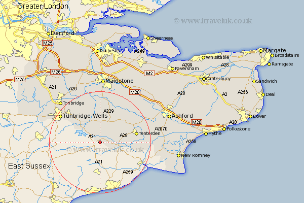
Kent Map Showing Location of Hawkhurst
Population: 3578
Area Size (ha): 98
District: Tunbridge Wells
Easting: 575270 Northing: 129026
Latitude: 51.03 Longitude: 0.5
 = Hawkhurst
Area Size (ha): 98
District: Tunbridge Wells
Easting: 575270 Northing: 129026
Latitude: 51.03 Longitude: 0.5
= Hawkhurst
This Hawkhurst map below is supplied by Google. Use the tools in the top left corner to zoom into street level or zoom out for a road map, you may also need to zoom in to see Hawkhurst on the map. Click and drag the map to move around. If the map fails to load try and refresh your browser or zoom in or out (+ or -).
Update - it seems Google no longer allow people to use their maps for free! This Hawkhurst map sometimes loads and sometimes gives a error. I am working on a solution.
Closest 30 Towns or Cities to Hawkhurst (Population over 500)
Hawkhurst 0km Sandhurst 5.01km Cranbrook 6.03km Beneden 6.11km Benenden 6.11km Goudhurst 8.2km Rolvenden 9.32km Lamberhurst 9.87km Horsmonden 10.38km Biddenden 11.91km Frittenden 12.55km Brenchley 13.13km Staplehurst 13.18km Tenterden 14.45km Wittersham 14.47km Marden 14.83km Headcorn 15.32km High Halden 16.13km Paddock Wood 16.92km Smarden 16.96km Pembury 16.96km Hunton 18.57km Turnbridge Wells 18.78km Tunbridge Wells 18.78km Royal Tunbridge Wells 18.78km Woodchurch 19.01km Sutton Valence 19.43km East Peckham 20.25km Linton 20.43km Boughton Monchelsea 20.53km