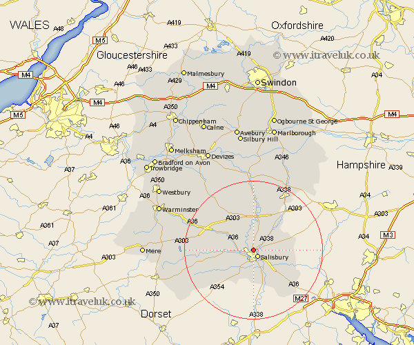
Wiltshire Map Showing Location of Old Sarum
District: Salisbury
Easting: 414007 Northing: 131631
Latitude: 51.08 Longitude: -1.8
 = Old Sarum
Easting: 414007 Northing: 131631
Latitude: 51.08 Longitude: -1.8
= Old Sarum
This Old Sarum map below is supplied by Google. Use the tools in the top left corner to zoom into street level or zoom out for a road map, you may also need to zoom in to see Old Sarum on the map. Click and drag the map to move around. If the map fails to load try and refresh your browser or zoom in or out (+ or -).
Update - it seems Google no longer allow people to use their maps for free! This Old Sarum map sometimes loads and sometimes gives a error. I am working on a solution.
Closest 30 Towns or Cities to Old Sarum (Population over 500)
New Sarum 2.18km Salisbury 2.18km Winterbourne Dauntsey 3.95km Winterbourne 3.95km Wilton 4.66km South Newton 5.01km Odstock 5.68km Britford 6.03km Coombe Bissett 6.57km Combebissett 6.57km Alderbury 7.25km Idmiston 8.05km Farley 8.95km Winterslow 9.31km Amesbury 9.35km Bishopstone 10.18km Downton 10.37km Steeple Langford 10.84km Longford 10.84km Lark Hill 11.18km Durrington 11.36km Broad Chalke 11.9km Redlynch 12.55km Dinton 12.81km Shrewton 13.13km Bulford 13.18km Whiteparish 13.99km Fovant 14.46km Figheldean 14.88km Ludgershall 16.67km