Durham Map Showing Location of Tees Norton
Easting: 444158 Northing: 521127
Latitude: 54.58 Longitude: -1.32
 = Tees Norton
Latitude: 54.58 Longitude: -1.32
= Tees Norton
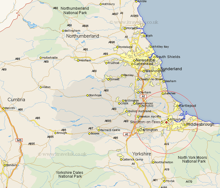
This Tees Norton map below is supplied by Google. Use the tools in the top left corner to zoom into street level or zoom out for a road map, you may also need to zoom in to see Tees Norton on the map. Click and drag the map to move around. If the map fails to load try and refresh your browser or zoom in or out (+ or -).
Update - it seems Google no longer allow people to use their maps for free! This Tees Norton map sometimes loads and sometimes gives a error. I am working on a solution.
Closest 30 Towns or Cities to Tees Norton (Population over 500)
Billingham on Tees 2.15km Billingham 2.15km Billingham-on-Tees 2.15km Stockton 2.58km Stockton on Tees 2.58km Stockton-on-Tees 2.58km Wolviston 4.29km Carlton 5.37km Thornaby 5.66km Thornaby on Tees 5.66km Thornaby-on-Tees 5.66km Grindon 5.68km Eaglescliffe 5.96km Egglescliffe 7.71km Greatham 7.73km Stillington 7.74km Yarm 9.51km Yarm-on-Tees 9.51km Yarm on Tees 9.51km Sedgefield 10.56km Elwick 11.33km Hartlepool 12.85km Fishburn 13.42km Trimdon 14.48km Hutton Henry 14.99km Hart 15.18km Bishop Middleham 15.45km Newton Aycliffe 16.53km Hurworth 17.03km Darlington 17.05km