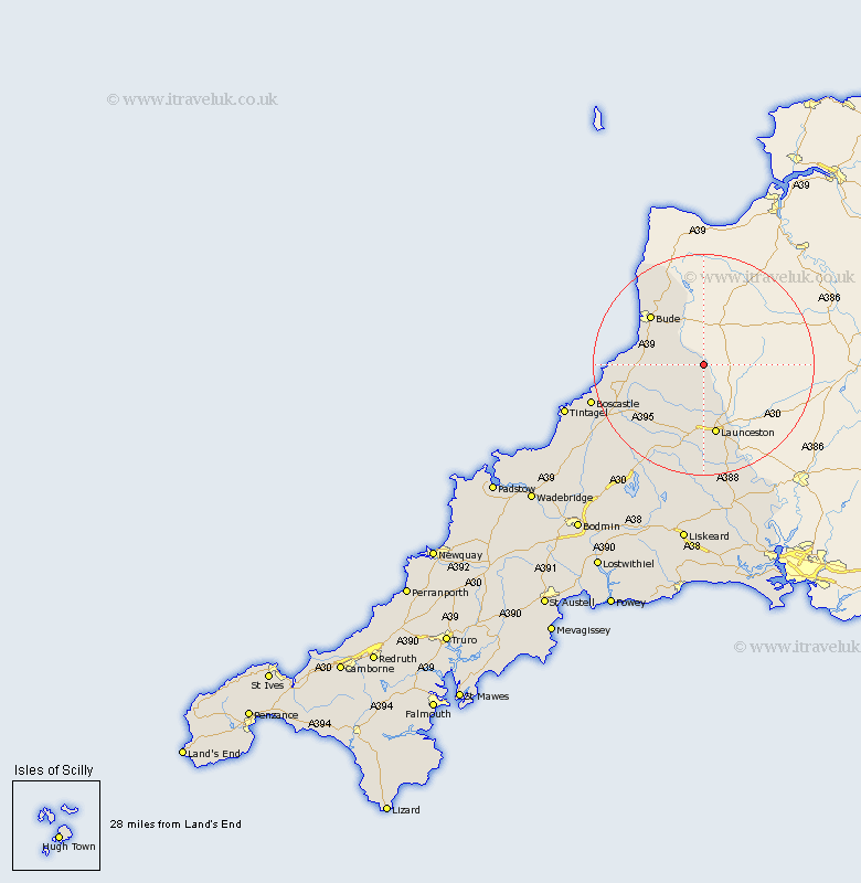
Cornwall Map Showing Location of North Tamerton
Population: 288
District: North Cornwall
Easting: 230715 Northing: 97298
Latitude: 50.75 Longitude: -4.4
 = North Tamerton
District: North Cornwall
Easting: 230715 Northing: 97298
Latitude: 50.75 Longitude: -4.4
= North Tamerton
This North Tamerton map below is supplied by Google. Use the tools in the top left corner to zoom into street level or zoom out for a road map, you may also need to zoom in to see North Tamerton on the map. Click and drag the map to move around. If the map fails to load try and refresh your browser or zoom in or out (+ or -).
Update - it seems Google no longer allow people to use their maps for free! This North Tamerton map sometimes loads and sometimes gives a error. I am working on a solution.
Closest 30 Towns or Cities to North Tamerton (Population over 500)
North Petherwin 7.78km Marhamchurch 9.91km Markhamchurch 9.91km Pounstock 10.71km Poundstock 10.71km Bude 13.18km Launceston 13.19km South Petherwin 14.87km Kilkhampton 15.94km Lewannick 16.84km Lezant 18.87km Altarnun 19.14km Moorwinstow 19.73km Morwenstow 19.73km North Hill 22.36km Forrabury 23.5km Linkinhorne 24.21km Camelford 24.86km Tintagel 26.33km Callington 28.68km Blisland 32.75km Calstock 32.84km Bere Alston 32.84km Liskeard 33.54km Dobwalls 34.36km Cardingham 34.5km Cardinham 34.5km Menheniot 35.23km Bodmin 38.62km Saltash 39.26km