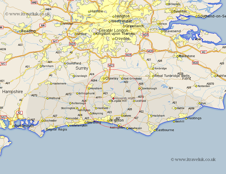
Sussex Map Showing Location of Haywards Heath
Population: 27862
Area Size (ha): 845
District: Mid Sussex
Easting: 533352 Northing: 122211
Latitude: 50.98 Longitude: -0.1
 = Haywards Heath
Area Size (ha): 845
District: Mid Sussex
Easting: 533352 Northing: 122211
Latitude: 50.98 Longitude: -0.1
= Haywards Heath
This Haywards Heath map below is supplied by Google. Use the tools in the top left corner to zoom into street level or zoom out for a road map, you may also need to zoom in to see Haywards Heath on the map. Click and drag the map to move around. If the map fails to load try and refresh your browser or zoom in or out (+ or -).
Update - it seems Google no longer allow people to use their maps for free! This Haywards Heath map sometimes loads and sometimes gives a error. I am working on a solution.
Closest 30 Towns or Cities to Haywards Heath (Population over 500)
Burgess Hill 2.98km Lindfield 2.98km Wivelsfield 3.88km South Nutfield 4.39km Cuckfield 4.39km Ardingly 5.68km Horsted Keynes 6.91km Botney 7km Bolney 7km Ditchelling 7.41km Ditchling 7.41km Balcombe 7.51km Hassocks 7.77km Keymer 7.77km Albourne 8.06km Newick 8.38km Hurstpierpoint 8.76km Slaugham 8.94km Chailey 8.97km Fletching 9.33km Lower Beeding 11.13km Turners Hill 11.18km Plumpton 11.66km Cowfold 11.67km Forest Row 12.06km Maresfield 12.83km Isfield 12.93km Barcombe Mills Station 13.16km Worth 13.18km Henfield 13.83km