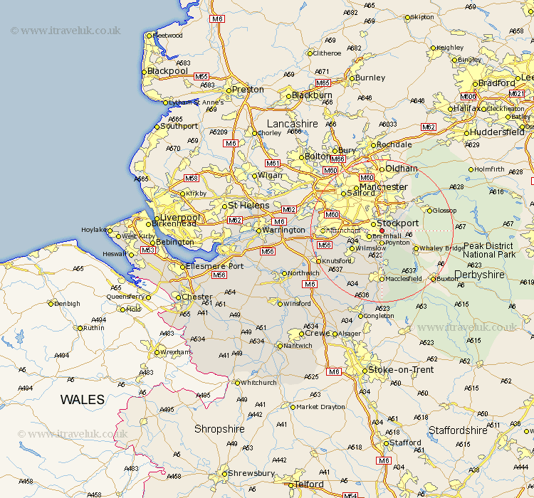
Cheshire Map Showing Location of Hazel Grove
Population: 38553
Area Size (ha): 1318
District: Stockport
Easting: 392240 Northing: 387419
Latitude: 53.38 Longitude: -2.12
 = Hazel Grove
Area Size (ha): 1318
District: Stockport
Easting: 392240 Northing: 387419
Latitude: 53.38 Longitude: -2.12
= Hazel Grove
This Hazel Grove map below is supplied by Google. Use the tools in the top left corner to zoom into street level or zoom out for a road map, you may also need to zoom in to see Hazel Grove on the map. Click and drag the map to move around. If the map fails to load try and refresh your browser or zoom in or out (+ or -).
Update - it seems Google no longer allow people to use their maps for free! This Hazel Grove map sometimes loads and sometimes gives a error. I am working on a solution.
Closest 30 Towns or Cities to Hazel Grove (Population over 500)
Hazel Grove 0km Stockport 2.89km Poynton 3.7km Bredbury 3.71km Bramhall 3.8km Disley 3.8km Marple 3.8km Romiley 4.32km Cheadle 6.89km Adlington 7.49km Hyde 7.74km Bollington 9.52km Wilmslow 9.53km Dukinfield 11.34km Prestbury 11.34km Prestburg 11.34km Stalybridge 11.6km Rainow 11.6km Longdendale 12.07km Alderley Edge 12.07km Sale 12.71km Nether Alderley 13.55km Alderley 13.55km Macclesfield 14.82km Mobberley 15.2km Altrincham 15.47km Chelford 16.35km Bowdon 16.69km Gawsworth 18.82km Knutsford 19.01km