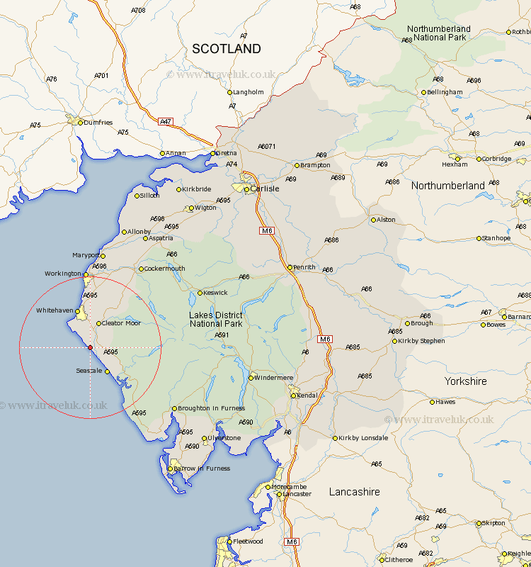
Cumbria Map Showing Location of Nethertown
District: Copeland
Easting: 299510 Northing: 507188
Latitude: 54.45 Longitude: -3.55
 = Nethertown
Easting: 299510 Northing: 507188
Latitude: 54.45 Longitude: -3.55
= Nethertown
This Nethertown map below is supplied by Google. Use the tools in the top left corner to zoom into street level or zoom out for a road map, you may also need to zoom in to see Nethertown on the map. Click and drag the map to move around. If the map fails to load try and refresh your browser or zoom in or out (+ or -).
Update - it seems Google no longer allow people to use their maps for free! This Nethertown map sometimes loads and sometimes gives a error. I am working on a solution.
Closest 30 Towns or Cities to Nethertown (Population over 500)
Egremont 2.84km St Bees 7.03km St. Bees 7.03km St Bega 7.03km Saint Bees 7.03km St. Bega 7.03km Saint Bega 7.03km Cleator Moor 7.72km Seascale 8.58km Gosforth 9.37km Frizington 10.21km Whitehaven 11.58km Parton 13.15km Distington 14.86km Lowca 14.98km Lamplugh 16.19km Dean 18.3km Workington 22.26km Bootle 23.59km Brigham 23.84km Flimby 26.03km Broughton Moor 26.49km Cockermouth 27.33km Maryport 27.98km Bridekirk 28.51km Dearham 28.8km Crosscanonby 32.39km Koswick 32.56km Keswick 32.56km Coniston 32.62km