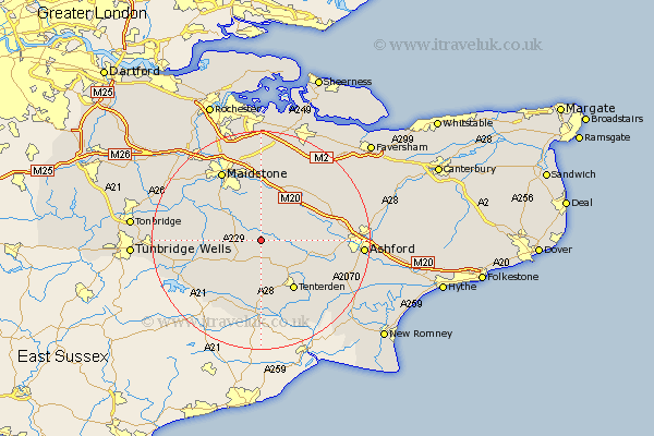
Kent Map Showing Location of Headcorn
Population: 2248
Area Size (ha): 63
District: Maidstone
Easting: 582986 Northing: 142284
Latitude: 51.15 Longitude: 0.62
 = Headcorn
Area Size (ha): 63
District: Maidstone
Easting: 582986 Northing: 142284
Latitude: 51.15 Longitude: 0.62
= Headcorn
This Headcorn map below is supplied by Google. Use the tools in the top left corner to zoom into street level or zoom out for a road map, you may also need to zoom in to see Headcorn on the map. Click and drag the map to move around. If the map fails to load try and refresh your browser or zoom in or out (+ or -).
Update - it seems Google no longer allow people to use their maps for free! This Headcorn map sometimes loads and sometimes gives a error. I am working on a solution.
Closest 30 Towns or Cities to Headcorn (Population over 500)
Frittenden 2.98km Smarden 5.01km Biddenden 5.68km Staplehurst 5.81km Ulcombe 6.03km Sutton Valence 6.03km Marden 8.34km Egerton 8.94km Leeds 9.26km Boughton Monchelsea 9.42km Cranbrook 9.43km Langley 9.55km Pluckley 10.01km Linton 10.18km High Halden 10.18km Harrietsham 10.36km Hunton 10.83km Tenterden 11km Bethersden 11.1km Hollingbourne 11.36km Benenden 11.36km Beneden 11.36km Loose 11.59km Lenham 11.59km Goudhurst 12.89km Rolvenden 13.03km Horsmonden 13.32km Bearsted 13.43km Charing 13.94km Hothfield 13.95km