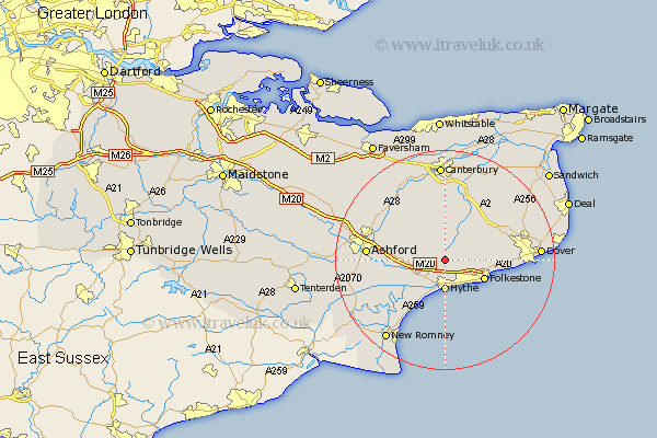
Kent Map Showing Location of Lyminge
Population: 1478
Area Size (ha): 61
District: Shepway
Easting: 615770 Northing: 139847
Latitude: 51.12 Longitude: 1.08
 = Lyminge
Area Size (ha): 61
District: Shepway
Easting: 615770 Northing: 139847
Latitude: 51.12 Longitude: 1.08
= Lyminge
This Lyminge map below is supplied by Google. Use the tools in the top left corner to zoom into street level or zoom out for a road map, you may also need to zoom in to see Lyminge on the map. Click and drag the map to move around. If the map fails to load try and refresh your browser or zoom in or out (+ or -).
Update - it seems Google no longer allow people to use their maps for free! This Lyminge map sometimes loads and sometimes gives a error. I am working on a solution.
Closest 30 Towns or Cities to Lyminge (Population over 500)
Elham 4.37km Hythe 5.56km Brabourne 6.1km Hawkinge 6.11km Sellindge 6.11km Sellinge 6.11km Lympne 6.56km Swingfield 7.22km Stelling 7.5km Folkestone 7.91km Folkstone 7.91km Smeeth 8.14km Aldington 10.02km Alkham 10.63km Hinxhill 10.63km Mersham 10.64km Petham 11.36km Lydden 12.2km Dymchurch 12.55km Shepherdswell 12.82km Sibertswold 12.82km Wye 12.82km Coldred 12.89km River 12.93km Lower Hardres 13.02km Bridge 13.17km Ewell 13.32km Temple Ewell 13.32km Ashford 14.08km Kennington 14.44km