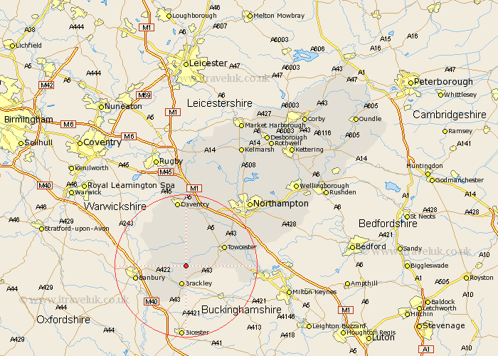
Northamptonshire Map Showing Location of Helmdon
Population: 938
District: South Northamptonshire
Easting: 459380 Northing: 243172
Latitude: 52.08 Longitude: -1.13
 = Helmdon
District: South Northamptonshire
Easting: 459380 Northing: 243172
Latitude: 52.08 Longitude: -1.13
= Helmdon
This Helmdon map below is supplied by Google. Use the tools in the top left corner to zoom into street level or zoom out for a road map, you may also need to zoom in to see Helmdon on the map. Click and drag the map to move around. If the map fails to load try and refresh your browser or zoom in or out (+ or -).
Update - it seems Google no longer allow people to use their maps for free! This Helmdon map sometimes loads and sometimes gives a error. I am working on a solution.
Closest 30 Towns or Cities to Helmdon (Population over 500)
Syresham 3.88km Greatworth 3.88km Brackley 5.68km Silverstone 7.97km Chipping Warden 9.84km Chalcombe 10.25km Chacombe 10.25km Whittlebury 10.25km Byfield 11.52km Towcester 11.65km Kings Sutton 11.75km Croughton 12.02km Pattishall 12.22km Paulerspury 13.67km Aynho 13.69km Boddington 13.82km Upper Boddington 13.82km Gayton 14.68km Badby 15.22km Bugbrooke 15.22km Weedon 15.51km Weedon Beck 15.51km Blisworth 16.5km Potterspury 17.19km Flore 17.63km Milton 18.5km Roade 18.61km Daventry 18.67km Kislingbury 18.69km Collingtree 19.42km