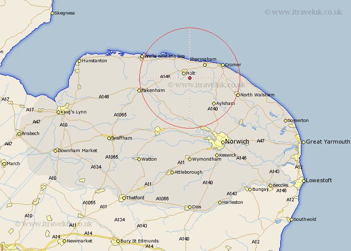
Norfolk Map Showing Location of Hempstead
Population: 179
District: North Norfolk
Easting: 609676 Northing: 336345
Latitude: 52.88 Longitude: 1.12
 = Hempstead
District: North Norfolk
Easting: 609676 Northing: 336345
Latitude: 52.88 Longitude: 1.12
= Hempstead
This Hempstead map below is supplied by Google. Use the tools in the top left corner to zoom into street level or zoom out for a road map, you may also need to zoom in to see Hempstead on the map. Click and drag the map to move around. If the map fails to load try and refresh your browser or zoom in or out (+ or -).
Update - it seems Google no longer allow people to use their maps for free! This Hempstead map sometimes loads and sometimes gives a error. I am working on a solution.
Closest 30 Towns or Cities to Hempstead (Population over 500)
Holt 2.91km Briston 5km Weybourne 5.99km Mellon Constable 6.71km Melton Constable 6.71km Corpusty 7.49km Sheringham 7.88km Hindolveston 10km Runton 10.53km West Runton 10.53km Erpingham 10.54km Blakeney 12.13km Roughton 12.3km Foulsham 12.99km Foulham 12.99km Cawston 13.39km Cromer 13.49km Aylsham 14.28km Northrepps 14.65km Reepham 14.82km Little Snoring 15.01km Ryburgh 15.34km Great Ryburgh 15.34km Little Walsingham 15.66km Walsingham 15.66km Marsham 15.76km Overstrand 16.08km Witchingham 16.68km Felmingham 17.25km Bawdeswell 17.6km