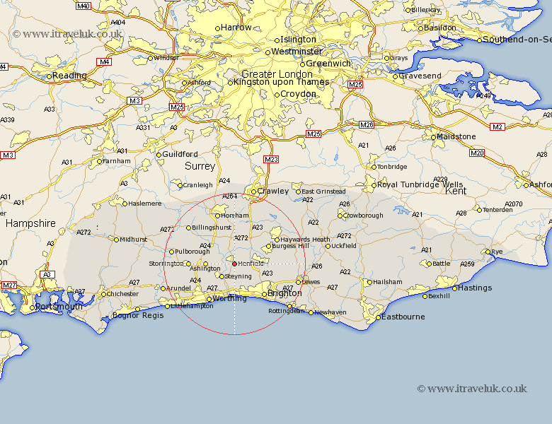
Sussex Map Showing Location of Henfield
Population: 3934
Area Size (ha): 108
District: Horsham
Easting: 521829 Northing: 114514
Latitude: 50.92 Longitude: -0.27
 = Henfield
Area Size (ha): 108
District: Horsham
Easting: 521829 Northing: 114514
Latitude: 50.92 Longitude: -0.27
= Henfield
This Henfield map below is supplied by Google. Use the tools in the top left corner to zoom into street level or zoom out for a road map, you may also need to zoom in to see Henfield on the map. Click and drag the map to move around. If the map fails to load try and refresh your browser or zoom in or out (+ or -).
Update - it seems Google no longer allow people to use their maps for free! This Henfield map sometimes loads and sometimes gives a error. I am working on a solution.
Closest 30 Towns or Cities to Henfield (Population over 500)
Steyning 5.1km Upper Beeding 5.1km Bramber 5.1km Upper Bleeding 5.1km Albourne 6.13km Hurstpierpoint 7.01km West Grinstead 7.26km Cowfold 7.41km Ashington 8.18km Bolney 8.76km Botney 8.76km Shipley 8.95km Keymer 9.35km Hassocks 9.35km Washington 9.53km Nuthurst 9.56km Shoreham by Sea 9.56km Shoreham 9.56km New Shoreham 9.56km Shoreham-by-Sea 9.56km Portslade 9.91km Southwick 9.91km Thakeham 10.68km Burgess Hill 10.87km Hove 10.96km Lower Beeding 11.18km Ditchelling 11.68km Ditchling 11.68km Findon 11.93km Lancing 12.06km