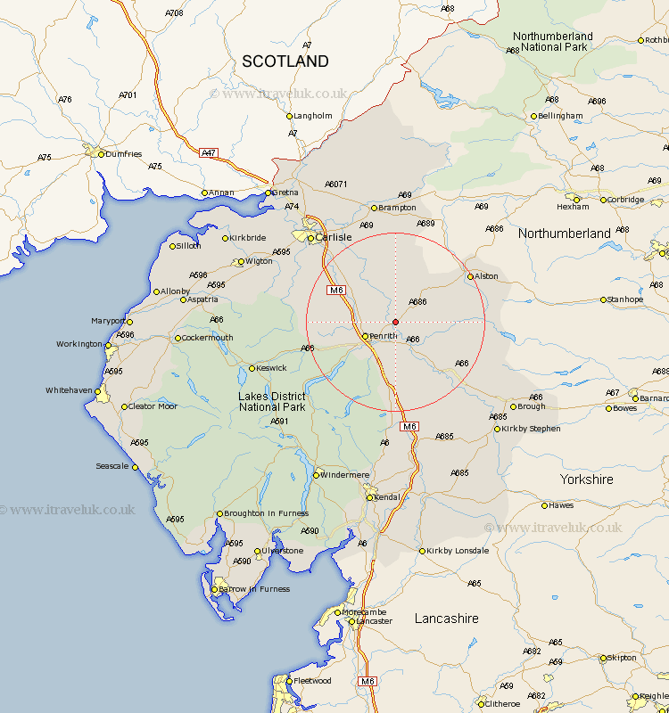
Cumbria Map Showing Location of Little Salkeld
District: Eden
Easting: 357040 Northing: 534101
Latitude: 54.7 Longitude: -2.67
 = Little Salkeld
Easting: 357040 Northing: 534101
Latitude: 54.7 Longitude: -2.67
= Little Salkeld
This Little Salkeld map below is supplied by Google. Use the tools in the top left corner to zoom into street level or zoom out for a road map, you may also need to zoom in to see Little Salkeld on the map. Click and drag the map to move around. If the map fails to load try and refresh your browser or zoom in or out (+ or -).
Update - it seems Google no longer allow people to use their maps for free! This Little Salkeld map sometimes loads and sometimes gives a error. I am working on a solution.
Closest 30 Towns or Cities to Little Salkeld (Population over 500)
Langwathby 1.86km Lazonby 4.28km Lasonby 4.28km Culgaith 7.02km Kirkoswald 7.72km Ainstable 11.91km Kirkby Thore 11.92km Skelton 12.85km Greystoke 14.01km Dacre 14.17km Long Marton 14.72km Long Marston 14.72km Appleby 18.95km Shap 20.38km Wetheral 20.88km Crosby Ravensworth 21.08km Hesket Newmarket 22.78km Hayton 22.87km Farlam 24.12km Caldbeck 24.9km Dalston 25.15km Carlisle 26.6km Irthington 26.72km Orton 26.73km Stanwix 28.05km Brampton 28.13km Thursby 28.71km Koswick 31.01km Keswick 31.01km Brough 31.19km