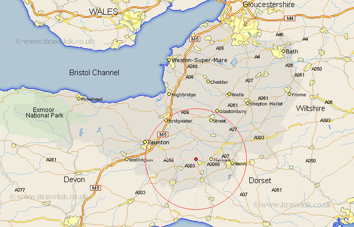
Somerset Map Showing Location of Lambrook
District: South Somerset
Easting: 341489 Northing: 118977
Latitude: 50.97 Longitude: -2.83
 = Lambrook
Easting: 341489 Northing: 118977
Latitude: 50.97 Longitude: -2.83
= Lambrook
This Lambrook map below is supplied by Google. Use the tools in the top left corner to zoom into street level or zoom out for a road map, you may also need to zoom in to see Lambrook on the map. Click and drag the map to move around. If the map fails to load try and refresh your browser or zoom in or out (+ or -).
Update - it seems Google no longer allow people to use their maps for free! This Lambrook map sometimes loads and sometimes gives a error. I am working on a solution.
Closest 30 Towns or Cities to Lambrook (Population over 500)
Kingsbury 2.98km Kingsbury Episcopi 2.98km South Petherton 2.98km Martock 5.84km Ilton 6.12km Curry Rivel 6.57km Fivehead 6.91km Ilminster 6.92km Long Sutton 7.26km Langport 7.41km West Chinnock 8.06km Tintinhull 8.17km Montacute 8.38km Haselbury Plucknett 9.44km Crewkerne 9.56km Broadway 10.05km Stoke St. Gregory 10.19km Stoke Saint Gregory 10.19km Stoke St Gregory 10.19km North Curry 10.86km Somerton 10.94km Ilchester 11.13km High Ham 11.18km Misterton 11.36km Hatch Beauchamp 11.81km West Coker 11.89km Yeovilton 12.24km Othery 13.43km Winsham 13.79km Combe St. Nicholas 13.84km