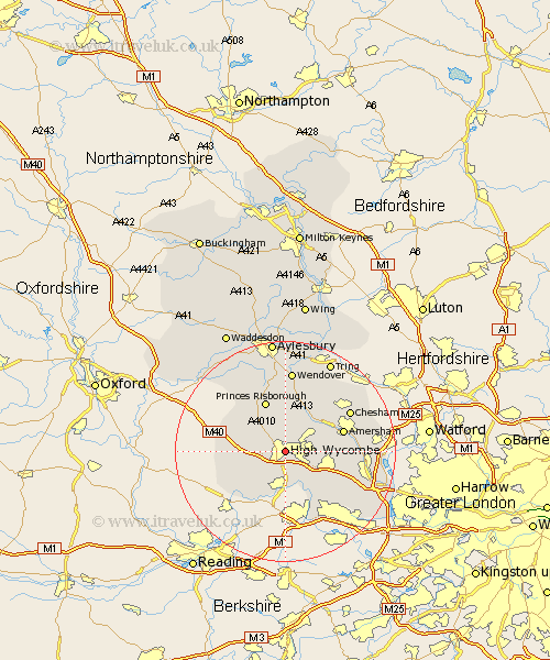
Buckinghamshire Map Showing Location of High Wycombe
Population: 70924
Area Size (ha): 1902
District: Wycombe
Easting: 485349 Northing: 193493
Latitude: 51.63 Longitude: -0.77
 = High Wycombe
Area Size (ha): 1902
District: Wycombe
Easting: 485349 Northing: 193493
Latitude: 51.63 Longitude: -0.77
= High Wycombe
This High Wycombe map below is supplied by Google. Use the tools in the top left corner to zoom into street level or zoom out for a road map, you may also need to zoom in to see High Wycombe on the map. Click and drag the map to move around. If the map fails to load try and refresh your browser or zoom in or out (+ or -).
Update - it seems Google no longer allow people to use their maps for free! This High Wycombe map sometimes loads and sometimes gives a error. I am working on a solution.
Closest 30 Towns or Cities to High Wycombe (Population over 500)
West Wycombe 2.3km Hughenden 2.96km Bradenham 2.96km Hazlemere 4.96km Flackwell Heath 5.91km Little Marlow 6.02km Penn 6.04km Lane End 7.15km Great Marlow 7.41km Marlow 7.41km Prestwood 7.76km Little Missenden 7.84km Bourne End 8.72km Great Missenden 8.73km Radnage 8.86km Wooburn 9.38km Stokenchurch 9.39km Princes Risborough 9.89km Beaconsfield 9.92km Hambleden 10.13km Medmenham 10.91km Lee 10.91km Amersham 10.99km Kimble 11.35km Great Kimble 11.35km Bledlow 11.56km Longwick 12.52km Ellesborough 13.03km Chesham 13.68km Hedgerley 13.69km