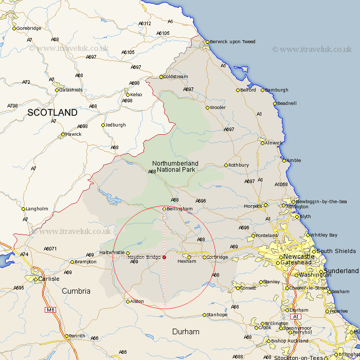
Northumberland Map Showing Location of Haydon Bridge
Population: 1735
Area Size (ha): 37
District: Tynedale
Easting: 385063 Northing: 563597
Latitude: 54.97 Longitude: -2.23
 = Haydon Bridge
Area Size (ha): 37
District: Tynedale
Easting: 385063 Northing: 563597
Latitude: 54.97 Longitude: -2.23
= Haydon Bridge
This Haydon Bridge map below is supplied by Google. Use the tools in the top left corner to zoom into street level or zoom out for a road map, you may also need to zoom in to see Haydon Bridge on the map. Click and drag the map to move around. If the map fails to load try and refresh your browser or zoom in or out (+ or -).
Update - it seems Google no longer allow people to use their maps for free! This Haydon Bridge map sometimes loads and sometimes gives a error. I am working on a solution.
Closest 30 Towns or Cities to Haydon Bridge (Population over 500)
Newbrough 4.89km Warden 6.64km Hexham 8.51km Acomb 8.71km Humshaugh 9.77km Wark 11.17km Chollerton 11.28km Challerton 11.28km Sandhoe 11.84km Haltwhistle 12.9km Corbridge 13.83km Slaley 14.77km Ridingmill 17.43km Riding 17.43km Bellingham 20.38km Stocksfield 20.56km Ovingham 23.4km Wylam 24.47km Stamfordham 24.53km Prudhoe 24.54km Otterburn 28.12km Newburn 31.92km Ponteland 32.18km Woolsington 35.52km Dinnington 36.27km Stannington 39.03km Gosforth 39.52km Newcastle-on-Tyne 40.43km Newcastle on Tyne 40.43km Newcastle upon Tyne 40.43km